Displaying 109 - 216 of 992
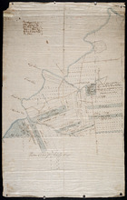
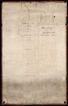
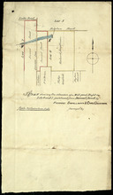
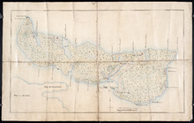
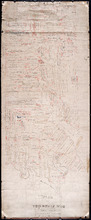
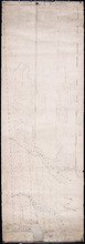
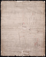
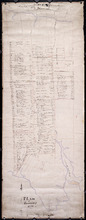
Eastern Division of Township No. 28
Description: Sketch of the eastern division of Lot 28 (No.33). DeBlois Estate.
Province: Prince Edward Island
Type: cadastral maps
Date Created: 1870-01-01
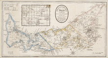
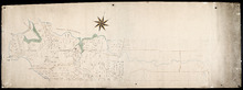
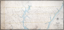
Prince Edward Island: divided into Counties & Parishes, with the Lots, as Granted by Government…
Description: Prince Edward Island divided into Counties and Parishes with the Lots as granted by Government, exhibiting all the New Settlements, Roads, Mills, etc. Published by H. Ashby, King Street, Cheapside,… more
Publisher: Ashby, H.
Province: Prince Edward Island
Type: cadastral maps
Date Created: 1798-03-01

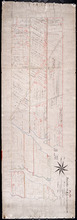
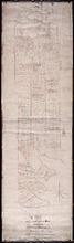
Plan of Township No. 29: embracing the Fane and Melville Estates – 1883
Description: Plan of Lot 29 (No.80). Fane and Melville Estates.
Province: Prince Edward Island
Type: cadastral maps
Date Created: 1883

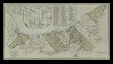
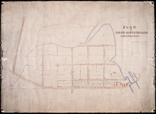
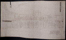
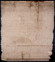
Plan of Township 30
Description: Plan of Lot 30 (No.82). Stewart Estate. Shows names of residents.
Province: Prince Edward Island
Type: cadastral maps
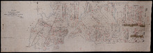
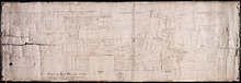
Lot 31: Southern portion
Description: Plan of the southern part of Lot 31, showing residents. In use 1819. From H.J. Cundall.
Province: Prince Edward Island
Type: cadastral maps

Lot 32
Description: Plan of Lot 32 showing some residents.
Province: Prince Edward Island
Type: cadastral maps

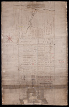
Plan of Township No. 33 in Prince Edward Island: Part of the Estate of John Hodges Winsloe Esq.…
Description: Plan of Lot 33. Winsloe Estate.
Province: Prince Edward Island
Type: cadastral maps
Date Created: 1834-09-20

Lot 34: Southern portion
Description: Part of Lot 34 (No.7). North side of Hillsborough River.
Province: Prince Edward Island
Type: cadastral maps

Plan of Lot 38
Description: Plan of Lot 38 showing the extent of land in possession of the Government...(?)
Province: Prince Edward Island
Type: cadastral maps

Plan of Lot or Township No. 39: from the lastest Surveys by Joseph Ball, S.G., July 1, 1857
Description: Plan of Lot 39 (No.104). Worrell Estate. Plan copied by Owen Curtis, 1876.
Province: Prince Edward Island
Type: cadastral maps
Date Created: 1857-07-01

Plan of Lot or Township No. 40: From latest Surveys by Joseph Ball and Owen Curtis, Land Surveyors.
Description: Plan of Lot 40 (No.109). Worrell Estate.
Province: Prince Edward Island
Type: cadastral maps

Plan of Lot or Township No. 41: From The Latest Surveys By Joseph Ball S.G., Copied by O. Curtis
Description: Plan of Lot 41 (No.111). Showing residents. Surveyed by Joseph Ball. Plan copied by Owen Curtis.
Province: Prince Edward Island
Type: cadastral maps

Lot 43: No. 1
Description: Plan of Lot 43 (No.1), showing Bay Fortune, Rollo Bay and North Shore areas.
Province: Prince Edward Island
Type: cadastral maps
Lot 43: Plan of that part of Division No. 1 Shaded Green on Lot or Township No. 43 containing 3467…
Description: Plan of that part of Lot 43 containing 3467 acres purchased by the Government.
Province: Prince Edward Island
Type: cadastral maps
Part of Lot 43
Description: Plan of part of Lot 43 (No.117). Townshend Estate.
Province: Prince Edward Island
Type: cadastral maps
Plan of Lot 44
Description: Plan of Lot 44. Old plan referred to in deed from Sir Ed. Cunard and others to the Commissioner for Public Lands, dated 13 July, 1866.
Province: Prince Edward Island
Type: cadastral maps
Date Created: 1866
Plan of Lot 45: Northern portion
Description: Plan of the northern part of Lot 45 (No.123), showing the names of some residents.
Province: Prince Edward Island
Type: cadastral maps

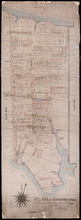
Plan of Township No. 64: St. Andrews Parish, Queens County, P. E. Island
Description: Lot 64 is situated in Kings County, not Queens County as stated in the map title. The map shows Lot 64 divided into parcels of land with names of residents and their acreage amounts. Several parcels… more
Province: Prince Edward Island
Type: cadastral maps
Date Created: 1850

Plan of the Western Portion of Township No. 65: containing 5250 acres and belonging to Mrs. Lydia…
Description: Plan of the western portion of Lot 65 (No.173). Estate of Mrs Lydia Wright. Roads, leased land[?] and freehold land on the Estate of Mrs. Lydia Wright. Tenant names appear on the sub-lots, which are… more
Province: Prince Edward Island
Type: cadastral maps
Date Created: 1841

Plan of Lot or Township No. 34
Description: Plan of Lot 34 (No. 90). Montgomery Estate. Working plan. The map shows Lot 34 divided into parcels of land with the names of residents and their acreage amounts handwritten in black ink. Land… more
Province: Prince Edward Island
Type: cadastral maps
Plan of the Division Line between Queens and Prince Counties & the Southern Boundary of…
Description: Plan of the division line between Queens and Prince Counties and the southern boundary of Lot 25 established by the Commissioners under the Boundary Line Act. Certified copy by G. Wright of 1835 plan… more
Province: Prince Edward Island
Type: boundary maps
Date Created: 1850
Plan of the Division Line between Queens and Prince Counties, & the Southern Boundary of…
Description: Plan of the division line between Queens and Prince Counties and the southern boundary of Lot 25, as established by the Commissioners under the Boundary Line Act. (No.81). The map shows the boundary… more
Province: Prince Edward Island
Type: boundary maps
Date Created: 1835
Plan of the Line dividing Kings and Queens Counties in Prince Edward Island as established by the…
Description: Plan of the line dividing Kings and Queens Counties in Prince Edward Island as established by the Commissioners under the provisions of the Act 4th: William 4th: Cap. 15 (No. 80). The map shows the… more
Province: Prince Edward Island
Type: boundary maps
Date Created: 1835

Office copy of that part of the Plan of the new line of Road leading from the Cardigan River to the…
Description: Plan of the new line of road leading from the Cardigan River to the Hillsborough River. Passes through Lots 51, 52, and 38. Plan copied by Geo. Wright, 12 August, 1837. The plan uses a dashed and… more
Province: Prince Edward Island
Type: engineering maps
Date Created: 1833
Plan of land appropriated by the Railway Commissioners in Lots 38 and 51
Description: Prince Edward Island Railway. Plan shows the land appropriated by the Railway Commissioners in Lots 38 and 51. The rail line is drawn in pink. Roads are shown in a lighter colour. Names of residents… more
Province: Prince Edward Island
Type: engineering maps
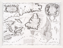
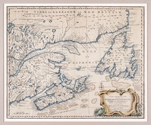
Carte de l'Accadie et Païs Voisins pour servir a l'Histoire Generale des Voyages: Par M.B…
Description: Rectangular map engraved on paper; framed and covered with glass. Coloured. Depicts Nova Scotia, P.E.I., Cape Breton, and part of New Brunswick; all place names in French. Highland areas in brown.… more
Province: Nova Scotia, New Brunswick, Prince Edward Island
Type: chorographic maps
Date Created: 1757
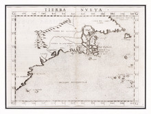
Tierra Nueva
Description: Rectangular black and white engraved map on paper; framed under glass. Map depicts eastern part of Canada including Cape Breton and Newfoundland. Shape rectangular Additional associations Frame HF.94… more
Type: chorographic maps
Date Created: 1561
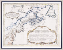
Canada Orientale nell' America Settentrionale: descritta dal P. Mro. Coronelli M C Cosmografo…
Description: Rectangular map, black on white paper. The map shows Newfoundland; Prince Edward Island; Anticosti Island; Cape Breton; part of mainland Nova Scotia; part of New Brunswick; part of Quebec; and part… more
Province: Newfoundland, Nova Scotia, Prince Edward Island
Type: topographic maps
Date Created: 1695
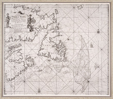
Pas-kaart, Vande Zee-Kusten van, Terra Nova, Met de Byleggende Zee-Kusten van Francia Nova Canada…
Description: Rectangular engraved map of Newfoundland, Nova Scotia, Prince Edward Island, and part of Quebec; framed and covered with glass. Black and white. Depicts Newfoundland, Nova Scotia, Cape Breton, Prince… more
Province: Newfoundland, Nova Scotia, Prince Edward Island, Quebec
Type: topographic maps
Date Created: 1687
A Map of the British and French Settlements in North America
Description: Framed map; presenting French territories as far south as the mouth of the Mississippi. The map shows bodies of water such as, the Hudson's Bay, the Great Lakes, Northren mountains, fishing… more
Type: chorographic maps
Date Created: 1760 (year approximate)
A New and Accurate Map of the Islands of Newfoundland, Cape Briton, St. John and Anticosta:…
Description: Map, showing the Maritime provinces; the vertical fold indicates that it originally appeared in a book or atlas; cartouche in bottom right corner. Port Joy is the only settlement named on Isle St.… more
Publisher: Astron Obervat
Province: Nova Scotia, Newfoundland, Cape Breton, St. John, Anticosta
Carte d'Une Partie de l'Amérique Septentrionale : Pour Servir à l'Intelligence du…
Description: Framed map of America in French, Title and a table of explanation along with an Avertissement are inside an elborate design. The map also shows bodies of water such as Lac Erie and Ontario, towns and… more
Province: Nova Scotia, Prince Edward Island, New Brunswick, Newfoundland
Type: topographic maps
Date Created: 1751
Partie Orientale de la Nouvelle France ou du Canada Avec L'Isle de Terre-Neuve et de Nouvelle…
Description: Map, image: elaborate decorations of ships and such figures as Neptune, Mercury and an allegorical figure representing the spirit of cartography who holds scales and a compass. Other embellishments… more
Type: pictorial maps, topographic maps
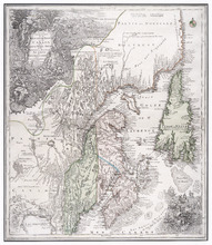
A New and Accurate Map of the Province of Nova Scotia, in North America, From the Latest…
Description: Framed map of the province of Nova Scotia and vicinity. The map shows bodies of water such as the Gulf of St. Lawrence and Bay of Fundy, towns, cities, villages, islands, banks, and a compass rose.
Province: Nova Scotia
Type: topographic maps, pictorial maps
Date Created: 1773

L'ACADIE: Par le Sr. Robert de Vaugindy Fils de Mr. Robert Geogr. ord, du Roy, Avec Privilege
Description: Period designation 18th century. The map shows bodies of water such as Baye Francoise, villages, towns, cities, mountains, trees, islands, and banks.
Province: Nova Scotia, Prince Edward Island
Type: topographic maps
Date Created: Unknown year in the century of the 1700s
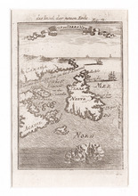
Die Insel der Neuen Erde : Isle de Terre New
Description: Two maps of Acadia in the 18th century in one frame; .1 coloured, .1 uncoloured. The map shows Canada, Acadie, and Terre Neuve, islands, water, and paintings of ships.
Type: pictorial maps
Date Created: 1690
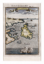
Die Insel der Neuen Erde : Isle de Terre Newe
Description: Two maps of Acadia in the 18th century in one frame; .1 coloured, .1 uncoloured.The map shows Canada, Acadie, and Terre Neuve, islands, water, and paintings of ships.
Province: Newfoundland, Nova Scotia, New Brunswick, Prince Edward Island
Type: topographic maps
Date Created: 1690

Carta Geographica Del Canada Nell' America Settentrionale
Description: Framed map of Canada; cartouche top left corner: natives by a pond with deer and animals which are part dog, part fish. The map shows bodies of water such as Baja D' Hudson, villages, towns, and… more
Type: chorographic maps
Date Created: 1700 to 1799

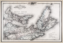
Atlas of the Maritime Provinces of the Dominion of Canada with historical and geological…
Publisher: Roe Brothers
Type: historical atlases
Date Issued: 1878

Plan of Township No. 9: compiled from the proprietors' plans and the descriptions in the…
Description: Plan of Lot 9 compiled from the proprietors plans and the descriptions in the leases and deeds, with additions and corrections from the various surveys. The map shows Lot 9 divided into parcels of… more
Province: Prince Edward Island
Type: cadastral maps
Date Created: 1909

Plan of Township No. 11: compiled from the plans by the late Alexander Anderson L. S on file in the…
Description: The map shows Lot 11 divided into parcels of land with names of residents, their acreage amounts and land conveyance references. Shows the P.E.I. Railway in red, roads in light brown. Bodies of water… more
Province: Prince Edward Island
Type: cadastral maps
Date Created: 1910

Plan of Township No. 56: referred to in the annexed Deed shewing the situation of lands conveyed by…
Description: Plan of Lot 56 showing the situation of 18,028 acres of land conveyed by T. Heath Haviland and G.W. DeBlois to the Commissioner of Public Lands. The map shows Lot 56 divided into parcels of land with… more
Province: Prince Edward Island
Type: cadastral maps

Plan Shewing the position of the Northern points of Commencement of the Lines dividing Lots 33 and…
Description: The map shows northern portions of Lots 24, 33, 34 and 35 along the north shore of Prince Edward Island. It shows the northern-most sections of three boundary lines: the line dividing Lots 24 and 33… more
Province: Prince Edward Island
Type: chorographic maps
Date Created: 1835-05-07
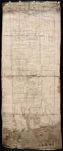
Plan of Lot 1
Description: Plan of Lot 1 comprising the Palmer and part of the Cunard Estates. Surveyed by V.S. Gillis and others. Rolled map on fabric backing. Water is coloured blue. Properties include owner / occupant names… more
Province: Prince Edward Island
Type: cadastral maps
Date Created: Unknown year


Plan of Township No. 13: From a Survey by Alex Anderson Copied from a Plan made by John Clay…
Description: Plan of Lot 13 - Yeo Estate.
Province: Prince Edward Island
Type: cadastral maps
Date Created: 1878

Plan of Township No. 16 in Prince Edward Island: The Estate of Laurence Sulivan Esq., Dept. Sect.…
Description: Plan of Lot 16, the estate of Lawrence Sullivan, Esq. Copied by Geo. Wright from a plan by James(?).
Province: Prince Edward Island
Type: cadastral maps
Date Created: 1851
Plan of Lot & Township No. 22 in Prince Edward Island: Part of the Estate of the Right…
Description: Plan of Lot 22 (No.59). Sullivan Estate.
Province: Prince Edward Island
Type: cadastral maps

Lot 22
Description: Plan of Lot 22 showing residents.
Province: Prince Edward Island
Type: cadastral maps
Plan of Township No. 24: Copied from plan furnished by Proprietors with numerous corrections from…
Description: Working plan of Lot 24 (No.67). Winsloe Estate. Surveyed by H.J Cundall and others; copied by Thos. MacKinlay.
Province: Prince Edward Island
Type: cadastral maps
Date Created: 1886-02
Lot 26
Description: Plan of Lot 26, partly finished by T. McKinlay. Residents shown for southern part of lot.
Province: Prince Edward Island
Type: cadastral maps

Lot 30: Refugee Share drawn for in Council this 18th day of September 1784, John Spencer
Description: Plan of Lot 30 (No.1) showing Refugee Shares drawn for in Council, 18 September, 1784.
Province: Prince Edward Island
Type: cadastral maps
Date Created: 1784

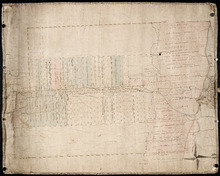
Plan of Township No. 30 belonging to R. Bruce Stewart, Drawn by Robt. Stewart 1861 from surveys…
Description: The map shows Lot 30 divided into numbered sub-lots. There are nine different series of sub-lot numbers which are colour-coded according to the map legend. The different colours represent Line Road,… more
Province: Prince Edward Island
Type: cadastral maps
Date Created: 1861
Plan shewing the situation of a Mill-pond Right on Lots 6 and 7, purchased from Samuel Sweet, by…
Description: Plan of part of Lots 6 and 7 showing the situation of a Mill-pond right purchased from Samuel Sweet by Richard Smallman and Chas. Crossman. The mill pond is located in the area where Lots 5, 6 and 7… more
Province: Prince Edward Island
Type: cadastral maps
Part of Lot No. 26
Description: Plan of part of Lot 26 (No.3). Plan traced[?] by J. Plaw from a survey by Mr. Major[?]. The maps shows part of Lot 26 (the Centreville area) divided into parcels of land with the names of residents… more
Province: Prince Edward Island
Type: cadastral maps
Date Created: 1810-05-23

Plan of Township No. 64: compiled from the proprietors' plans, descriptions in leases and…
Description: The map shows Lot 64 divided into parcels of land with names of residents, their acreage amounts and land conveyence references. Land information written in black indicates government land;… more
Province: Prince Edward Island
Type: cadastral maps
Date Created: 1920
Plan of Township No. 20.: Compiled from Surveys by Jas. Stewart, L. W. Gall, George Wright, Joseph…
Description: Plan of Lot 20. The map shows Lot 20 divided into parcels of land with names of some residents and some acreage amounts. The map notes freehold land. Shows roads in a light brown colour, marsh areas… more
Province: Prince Edward Island
Type: cadastral maps

Plan of Township No. 5: compiled from plans, leases, deeds, and other documents on file in the Land…
Description: Plan of Lot 5 compiled from plans, leases, deeds, and other documents on file in the Land Office. The map shows Lot 5 divided into parcels of land with names of residents, their acreage amounts and… more
Province: Prince Edward Island
Type: cadastral maps
Date Created: 1911-09

Plan of Town Lots at Cascumpec Point. Township No. 5.: Compiled and corrected from Surveys by John…
Description: Plan of Town Lots at Cascumpec Point, Lot 5. The map shows Cascumpec Point divided into parcels of land (most of them numbered) with names of residents. Shows land belonging to J. C. Pope outlined in… more
Province: Prince Edward Island
Type: cadastral maps
Date Created: 1877-08-01

Plan of Cascumpec Point Copied from a Plan in the Public Lands Departt. furnished by John Ball. L.…
Description: Plan of Cascumpec Point, Lot 5. The map shows numbered parcels of land on Cascumpec Point with names of residents and some land conveyance references. The legend indicates that parcels are outlined… more
Province: Prince Edward Island
Type: cadastral maps
Date Created: 1885-06
Plan of Township No. 6: Compiled from plans, leases, deeds, and other documents on file in the Land…
Description: The map shows Lot 6 divided into parcels of land with names of residents, their acreage amounts and land conveyance references handwritten in black and red ink. Shows the P.E.I. Railway in red, roads… more
Province: PE
Type: cadastral maps
Date Created: 1912-01
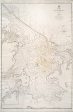
Hillsborough Bay
Description: Paper map in frame. Nautical chart originally published in 1842 and corrected and reissued many times. Large corrections in 1860, 1868, 1869, 1881. Relief is described pictorially, with hachures,… more
Publisher: Office of the Admiralty
Province: Prince Edward Island
Type: nautical charts
Date Issued: 1929
Date Created: 1842
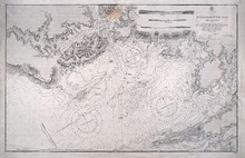
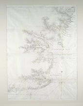
Richmond Bay: 1845
Description: Paper map in frame. Nautical chart originally published in 1845. Relief is described pictorially, with hachures, stippling and soundings. Bays, capes, heads, harbours, islands, lakes, ports, points,… more
Publisher: Hydrographic Office of the Admiralty
Province: Prince Edward Island
Type: nautical charts
Date Issued: 1850
Date Created: 1845
Plan of Île Saint-Jean: The Island of Saint John
Description: Plan of Ile Saint-Jean / the Island of Saint John. The map shows Prince Edward Island and a portion of the mainland. It identifies settlements, bays, harbours, rivers and islands. Sandy areas are… more
Province: Prince Edward Island
Type: topographic maps
Date Created: 1760
Plan Showing the Situation of Joseph Hammil's Farm on Lot No. 2. Containing Thirty acres on…
Description: Plan of part of Lot 2 showing Joseph Hammill's Farm containing 30 acres. The map shows Joseph Hammill's 30-acre parcel shaded in a greenish colour. It also shows the adjacent parcel of John… more
Province: PE
Type: cadastral maps
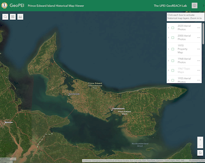
GeoPEI: Prince Edward Island Historical Map Viewer
Description: GeoPEI is a web portal developed by Dr. Josh MacFadyen and students in the GeoREACH Lab. Its purpose is to share maps, atlases, aerial photos, and geospatial data in an online map (aka. a webmap)… more
Publisher: UPEI GeoREACH Lab
Province: Prince Edward Island
Type: aerial photographs, cadastral maps
Date Created: 2024

IslandImagined - Digital Map Collection
Description: The Island Imagined is an online collection of historic maps of Prince Edward Island. The collection features maps, atlases, books, images, and documents from the Prince Edward Island Public Archives… more
Province: Prince Edward Island
Type: maps
A New Chart of the Gulf of St. Lawrence Compiled from the Original Drawings of Actual Surveys
Description: The most accurate chart of the Gulf of St. Lawrence in 1790, especially its depiction of Cape Breton Island. "The Most Detailed Chart of the St. Lawrence River to Date Fine example of Thomas… more
Publisher: William Faden
Province: Prince Edward Island, Nova Scotia, New Brunswick, Quebec
Type: nautical charts
Date Created: 1790
Prince Edward Island
Publisher: Chas. E. Goad, Civil Engineer
Type: fire insurance maps
Date Issued: 1888
Date Modified: 1910-08, 1917-07
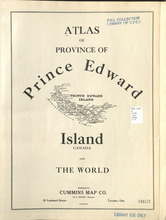
Atlas of Province of Prince Edward Island, Canada and the World
Description: Cummins devotes most of its opening pages to a detailing of the Island’s contribution to the First World War or “European War”. This event had forever changed many communities on the Island.
More… more
Publisher: Cummins Map Co.
Type: historical atlases
Date Issued: 1927

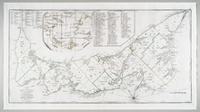
Illustrated historical atlas of the province of Prince Edward Island: From surveys made under the…
Description: Published in 1880 by the J. H. Meacham Company, the Illustrated Historical Atlas of the Province of Prince Edward Island contains maps of each Lot on the Island, maps of Charlottetown and various… more
Publisher: J. H. Meacham & company
Type: historical atlases, pictorial maps
Date Issued: 1880
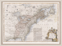
New Railway and Postal Map of the Dominion of Canada, Sheet No. 2
Description: Framed map shows the post offices, money order offices, P.O. saving offices, telegraph sections, ports of entry, railways and the distance between towns over post roads of the time. Prince Edward… more
Province: Prince Edward Island
Type: geological maps
Date Created: 1880
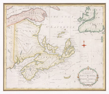
A Map of the Island of St. John in the Gulf of St. Laurence: Divided into Counties and Parishes and…
Description: The map shows the province of Prince Edward Island, but known to this map as St. John, and its counties. Shown are bodies of water, lots, cities, towns. roads, buildings, and Islands.
Type: topographic maps
Date Created: 1775-04-06
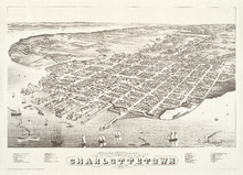
Panoramic view of Charlottetown, Prince Edward Island: 1878
Description: Panoramic, bird's eye view of Charlottetown from the harbour. Ships of various kinds, including sail and steam-powered, pictured in the foreground. View shows a busy, industrial waterfront with… more
Publisher: Prince Edward Island Museum and Hertiage Foundation
Province: Prince Edward Island
Type: bird's-eye views
Date Issued: 1983
Date Created: 1878
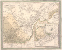
Canada East formerly Lower Canada
Description: Includes Quebec and Maritimes. Colour by region - primarily beige, yellow, green (compared to other versions of this map, the colours are muted). Inset map includes numbered counties for New… more
Publisher: Mitchell, S. Augustus, S. Augustus Mitchell
Province: Prince Edward Island
Date Created: 1846
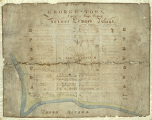
Plan of George-Town: Capital of Kings County, Prince Edward Island
Description: A hand-drawn map of Georgetown, PEI that includes the layout of the town including Kent Square, the ranges, house lots, water lots, and buildings. Three Rivers borders the town.
Province: Prince Edward Island
Date Created: 1835

Map of Prince Edward Island in the Gulf of St. Lawrence: for McGregor's British America
Publisher: Ballantyne and Company
Province: Prince Edward Island
Type: cadastral maps, topographic maps
Date Created: 1832
Plan of Township No. 56: Copied from the Survey of J. C. Underhay By Owen Curtis. L. S.
Description: Plan of Lot 56 (No.150). Shows names of residents, acreage, and some land conveyance references. Surveyed by J.C. Underhay and copied by Owen Curtis. The map also shows bodies of water such as… more
Province: Prince Edward Island
Type: cadastral maps
Plan of Lot 50
Description: Plan of Lot 50. Shows names of residents, acreage, and some land conveyance references, roads, and bodies of water such as rivers (Orwell), and bays (Pownal).
Province: Prince Edward Island
Type: cadastral maps

Plan of Township No. 55: Compiled from the plans on file in the Land and Registry Offices, from the…
Description: Plan of Lot 55 compiled from the plans on file in the Land and Registry Offices, from the descriptions in the registered Grants and from Meacham's Atlas. Shows names of residents, acreage, and… more
Province: Prince Edward Island
Type: cadastral maps
Date Created: 1919

Township No. Fiftyfour. St. Georges Parish. Kings County. Prince Edward Island.: Chiefly from…
Description: Plan of Lot 54 (No.145). Shows names of residents, acreage, and some land conveyance references. Copied by H.J. Cundall. Certified plan. The map also shows bodies of water such as rivers (Cardigan),… more
Province: Prince Edward Island
Type: cadastral maps
Plan of the Estate of the Hon. Spencer Cecil Brabazon Ponsonby Fane Situate on Lot or Township No.…
Description: Plan of Lot 53 showing the estate of the Hon. Spencer Cecil Brabazon Ponsonby Fane. Copied by R.T. Weeks. Shows names and acreage of some residents, roads, and rivers such as Morell.
Province: Prince Edward Island
Type: cadastral maps
Plan of Lot or Township No. 53, shewing the positions of the respective boundaries thereof. Those…
Description: Plan of Lot 53 showing the position of the boundaries of the Melville, Selkirk and Westmoreland Estates (No.5). Shows names and acreage of a few residents, bodies of water such as rivers (Brudnell),… more
Province: Prince Edward Island
Type: cadastral maps
Royalty of Georgetown
Description: Plan of Lot 53 showing the estate of Lady Westmoreland. Shows names of residents and acreage, roads, and bodies of water such as rivers (Montague). Also shows the division line between the estate of… more
Province: Prince Edward Island
Type: cadastral maps
Plan Township No. 53. comprising parts of the Melville, Selkirk, and Fane Estates. Compiled and…
Description: Plan of Lot 53 comprising parts of the Melville, Selkirk and Fane Estates (No.144). Shows names, acreage, and land conveyance references for some residents, bodies of water such as rivers, and… more
Province: Prince Edward Island
Type: cadastral maps
Plan of Pierce Gaul's Estate Montague-Bridge
Description: Plan of Pierce Gaul's Estate, Montague Bridge, Lot No.52. The map shows the Montague River, streets, and buildings. more
Province: Prince Edward Island
Type: cadastral maps
Date Created: 1877-05

Plan of Lot or Township No. 51 in Kings County P. E. Island
Description: Plan of Lot 51 (No.139) Colour code shows freehold and unsold portions. Sir Graham Montgomery Estate. Shows names, acreage, and land conveyance references of some residents, and roads.
Province: Prince Edward Island
Type: cadastral maps
Plan of Township No. 50, the Property of Maria Susanna Matilda Fanning
Description: Plan of Lot 50, the property of Maria Susanna Matilda Fanning. Shows names of residents, acreage, and land conveyance references, bodies of water such as rivers (Vernon), bays (Pownal), and roads.… more
Province: Prince Edward Island
Type: cadastral maps

Plan of certain tracts of land at or near Orwell according to registered deeds, and two surveys…
Description: Plan of part of Lot 50. Clark's Corner, Orwell. Shows certain tracts of land at or near Orwell according to registered deeds and two surveys. Rough copy included. more
Province: Prince Edward Island
Type: cadastral maps

Plan of Part of Township No. 49. Bedford Parish. Queens County. P. E. Island.
Description: Plan of part of Lot 49 (No.135). One of the plans referred to in the deed from Sir Edward, William, and Laura Cunard to the Commissioner of Public Lands, July 13, 1866. The portion of land intended… more
Province: Prince Edward Island
Type: cadastral maps
Date Created: 1850
Plan of part of Lot 50
Description: Plan of part of Lot 50 (No.13). Area east of the Murray Harbour Road, north of the Dundee Road, and south of Georgetown Road. Shows names of residents.
Province: Prince Edward Island
Type: cadastral maps

Plan of Township Number 49. Shewing "Cunard" portion borderd. yellow. "Loan Act…
Description: Plan of Lot 49 showing Cunard portion bordered yellow, Loan Act Land bordered green, and remainder of Township (No.134). Copied from Meacham's Atlas by Owen Curtis. Shows names of residents,… more
Province: Prince Edward Island
Type: cadastral maps
Date Created: 1883-08
Plan of Lot 48 east of Fullerton's Creek
Description: Plan of that part of Lot 48 east of Fullerton's Creek. Shows names of residents and acreage. (No.13 in Plan Book) (Also, No.924) more
Province: Prince Edward Island
Type: cadastral maps
Date Created: 1874-01
Lot 45 (No.122)
Description: Plan of the northeastern part of Lot 45 (No.122). Shows names of residents and acreage and a nautical compass.
Province: Prince Edward Island
Type: cadastral maps
Plan of Township No. 44. Corrected from Surveys by Owen Curtis, J. C. Underhay and others. By Thos…
Description: Plan of Lot 44 (No.118) corrected by Thomas MacKinlay from surveys by Owen Curtis, J.C. Underhay and others. Cunard Estate. Shows some residents' names, acreage, and land conveyance references,… more
Province: Prince Edward Island
Type: cadastral maps
Date Created: 1887-09
Plan of Township No. 44.
Description: Plan of Lot 44 (No.120). Cunard Estate. Shows names and acreage of some residents, bodies of water such as rivers and gulfs, roads, and a mills (MacGowans).
Province: Prince Edward Island
Type: cadastral maps
A Plan of Lot or Township No. 43, Comprising the Haviland, Townsend, and Worrell Estates. Compiled…
Description: Plan of Lot 43 (No.116) comprising the Haviland, Townshend, and Worrell Estates. Completed from the surveys of J. Ball and J.C. Underhay by Owen Curtis. Shows names of residents, acreage, and land… more
Province: Prince Edward Island
Type: cadastral maps
Date Created: 1876-08

Plan of Lot 42 (No.112)
Description: Plan of Lot 42 (No.112). Shows names and acreage of some residents, bodies of water, and roads.
Province: Prince Edward Island
Type: cadastral maps

Pla of Lot or Township No. 42
Description: Plan of Lot 42 (No.113). Worrell Estate. Shows names of residents, acreage, and land conveyance references.
Province: Prince Edward Island
Type: cadastral maps
A Map and Survey of Part of Township Number Thirtyfive south side of the Hillsborough river, by…
Description: A map and survey of part of Lot 35, south side of the Hillsborough River. Shows names of residents, acreage, and land conveyance references, bodies of water such as rivers, and raods.
Province: Prince Edward Island
Type: cadastral maps
Date Created: 1887-03

Plan of Lot 39
Description: Plan of Lot 39. Shows names of residents and acreage, bodies of water such as rivers, and bays, and division lines.
Province: Prince Edward Island
Type: cadastral maps
Date Created: 1857-07-01
Plan of Lot or Township No. 38: Compiled from the Survey of Jos.h Ball by O. Curtis, Land Office…
Description: Plan of Lot 38 (No.102). Shows names of residents, acreage, and some land conveyance references, bodies of water such as bays, rivers, ponds, gulfs, and harbours, roads, and a nautical compass.
Province: Prince Edward Island
Type: cadastral maps
Date Created: 1876-08

Plan of Lot Thirty Seven: Queens Co., P.E.I.
Description: Map of Lot 37 and part of Lot 38. Map is from Meacham's 1880 PEI Historical Atlas. A few land conveyance references have been added in red ink. The map shows bodies of water such as rivers,… more
Province: Prince Edward Island
Type: cadastral maps
Date Created: 1880