Displaying 109 - 216 of 297
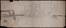
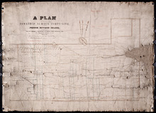
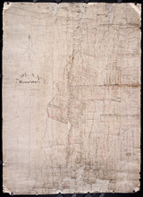
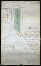
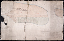
Plan of the Indian Reserve on Township No. 36
Description: Plan of part of Lot 36. The map shows a parcel of land, approximately 150 acres in size, identified as an Indian Reserve on the north side of the Hillsborough in Lot 36. The parcel is outlined in… more
Province: Prince Edward Island
Type: cadastral maps
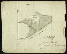
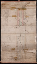
A Plan of the French Marsh: the property of Wm. Townshend. Esqr.
Description: Plan of part of Lot 37 (No.9). The French Marsh. The map shows a marsh area belonging to William Townshend on the north side of the Hillsborough River in Lot 37. Marsh area is shaded and coloured… more
Province: Prince Edward Island
Type: cadastral maps, topographic maps
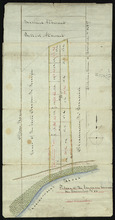
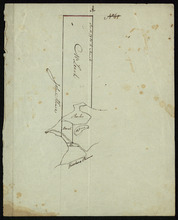
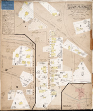
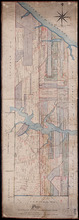
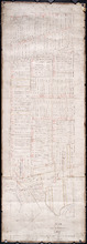
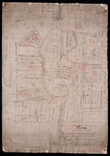
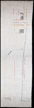
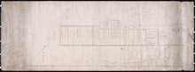
Lot 37 - No. 7
Description: Plan of part of Lot 37 (No. 7). Area south of the Hillsborough River. The maps shows a small area on the south side of the Hillsborough River in Lot 37 adjacent to the boundary with Lot 38. It shows… more
Province: Prince Edward Island
Type: cadastral maps
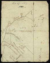
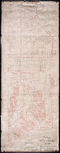
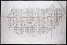
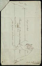
Plan of 150 Acres of Land Part of Lot No. 37.
Description: Plan of part of Lot 37 (No. 8). 150 acres of land, the property of John Stowe. The map shows a parcel of land, approximately 150 acres in size, outlined in yellow, on the north side of the… more
Province: Prince Edward Island
Type: cadastral maps
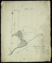
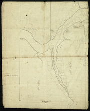
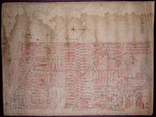
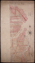
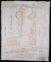
Plan of the French Marsh: Lot 37 - No. 10
Description: Plan of part of Lot 37 (Nos. 10 and 58). This item consists of three maps on three separate sheets, all showing the same area. The maps show the French Marsh on the north side of the Hillsborough… more
Province: Prince Edward Island
Type: cadastral maps, topographic maps
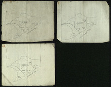
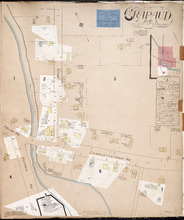
Lot 37 - No. 12
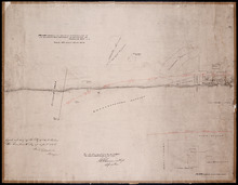
Description: Plan of part of Lot 37 (No. 12). The Pisquid or Hill River area. Outline. The map shows the area where the Pisquid (or Hill) River joins the Hillsborough River in Lot 37. It gives the names of some… more
Province: Prince Edward Island
Type: cadastral maps, topographic maps
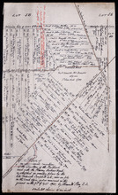
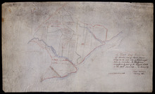
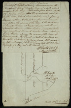
Part of Lot 37
Description: Plan of part of Lot 37 (No. 13). Property of Mr. Leech.[?] The map shows a parcel of land on the north side of the Hillsborough River in Lot 37. It gives the names of two residents. The map shows the… more
Province: Prince Edward Island
Type: cadastral maps
The Original Plan of Charlottetown Lots, No.1.
Description: Early plan of Charlottetown entitled "The Original Plan of Charlottetown Lots, No.1." Shows town lots, houses, windmill, battery, gallows, and the names of residents. Also includes code… more
Province: Prince Edward Island
Type: cadastral maps
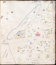
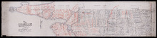
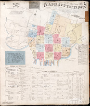
Charlottetown, P.E.I.: July, 1903
Description: This is Page 17 of 20 pages of fire insurance maps of Charlottetown. It was created in 1903 and revised to either 1910 or 1917. It shows an area bounded by Brighton Road and Euston Street to the… more
Publisher: Chas. E. Goad, Civil Engineer
Province: Prince Edward Island
Type: fire insurance maps
Date Created: 1903-07
Date Modified: 1910-08, 1917-07 (year and month uncertain)
Date Issued (Source): 1888
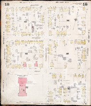
Charlottetown P.E.I.: July, 1903.
Description: This is Page 18 of 20 pages of fire insurance maps of Charlottetown. It was created in 1903 and revised to either 1910 or 1917. It shows the area from Euston Street to Grafton Street, between… more
Publisher: Chas. E. Goad, Civil Engineer
Province: Prince Edward Island
Type: fire insurance maps
Date Created: 1903-07
Date Modified: 1910-08, 1917-07 (year and month uncertain)
Date Issued (Source): 1888
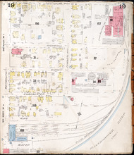
Charlottetown P.E.I.: July 1903
Description: This is Page 19 of 20 pages of fire insurance maps of Charlottetown. It was created in 1903 and revised to either 1910 or 1917. It shows the area from Grafton Street to Water Street, between Weymouth… more
Publisher: Chas. E. Goad, Civil Engineer
Province: Prince Edward Island
Type: fire insurance maps
Date Created: 1903-07
Date Modified: 1910-08, 1917-07 (year and month uncertain)
Date Issued (Source): 1888
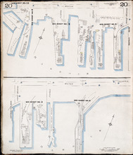
Charlottetown P.E.I.: July 1917. Reprinted.
Description: This is Page 20 of 20 pages of fire insurance maps of Charlottetown. It shows Water Street in two (2) sections that are intended to be continuous. The section at the top of the page shows Water… more
Publisher: Chas. E. Goad, Civil Engineer
Province: Prince Edward Island
Type: fire insurance maps
Date Created: 1917-07
Date Issued (Source): 1888
Crapaud P.E.I.: Population 300. No Appliances. Novr. 1897.
Description: This is a fire insurance plan of the village of Crapaud. It was created in 1897 and revised to 1910. The main map shows Main Street and the area where the roads into town converge. The Crapaud… more
Publisher: Chas. E. Goad, Civil Engineer
Province: Prince Edward Island
Type: fire insurance maps
Date Created: 1897-11
Date Modified: 1910-10
Date Issued (Source): 1888
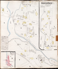
Hunter River P.E.I. Kings Co.: Population 150. No Protection. Oct. 1910.
Description: This is a fire insurance plan of Hunter River. It shows the town in two (2) sections that are intended to be continuous. The sections show the area around the California Road and the Malpeque Raod. A… more
Publisher: Chas. E. Goad, Civil Engineer
Province: Prince Edward Island
Type: fire insurance maps
Date Created: 1910-10
Date Issued (Source): 1888
Mount Stewart Prince Edward Island: Population 400. No Appliances. October 1893.
Description: This is a fire insurance plan of the village of Mount Stewart consisting of two maps--one for each side of the Hillsborough River. It was created in 1893 and revised to 1910. The smaller map, on the… more
Publisher: Chas. E. Goad, Civil Engineer
Province: Prince Edward Island
Type: fire insurance maps
Date Created: 1893-10
Date Modified: 1910-09
Date Issued (Source): 1888
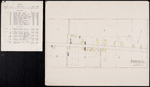
Pownal, Lot 49
Description: This item consists of a fire insurance plan of the community of Pownal and an accompanying typewritten text document. The map shows Pownal divided into numbered sections. It shows buildings and their… more
Province: Prince Edward Island
Type: fire insurance maps
Date Issued (Source): 1888
Vernon River Bridge, Lot 50
Description: This item consists of a fire insurance plan of the community of Vernon River Bridge and an accompanying handwritten text document. The map of Vernon River shows the community divided into numbered… more
Province: Prince Edward Island
Type: fire insurance maps
Date Issued (Source): 1888
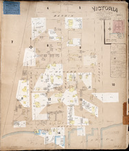
Victoria P.E.I.: Population 300. No appliances. Chas E Goad Civil Engineer Toronto & Montreal.…
Description: This is a fire insurance plan of the village of Victoria. It was created in 1893 and revised to October, 1910. It shows the area from Bardin Street to the waterfront, between Nelson and Russell… more
Publisher: Chas. E. Goad, Civil Engineer
Province: Prince Edward Island
Type: fire insurance maps
Date Created: 1893-10
Date Modified: 1910-10
Date Issued (Source): 1888

Plan of Lot 23
Description: Plan of Lot 23. Shows names of residents in central portion of Lot, i.e. around Clyde River.
Province: Prince Edward Island
Type: cadastral maps

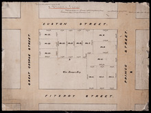
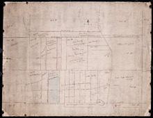
Plan of Building Lots in Common Lots Nos. 28 and 29 (Palmer Estate)
Description: Plan of building lots in Common Lots No.28 and No.29. The Palmer Estate. The map also shows streets such as Euston, Orlebar, lot numbers and acreage.
Province: Prince Edward Island
Type: cadastral maps
Date Created: 1913

Plan of Right of Way as on the Ground part of Town Lot No. 36 in the 4th Hund. Charlottetown.
Description: Plan of the Right of Way through Town Lot No.36 in the 4th Hundred in Charlottetown. (No.40). The map shows Kent Street and landowners.
Province: Prince Edward Island
Type: cadastral maps
Date Created: 1898-06
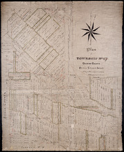
Plan of Township No. 67 Queens County Prince Edward Island: A Copy of a Plan compiled by Geo.…
Description: A copy of a plan of Lot 67 compiled by Geo. Wright, 1858, slightly altered to agree with Meacham's Atlas (No.179). Shows names of residents and acreage, lots, streets and roads, and post offices. more
Province: Prince Edward Island
Type: cadastral maps
Date Created: 1885-07

Plan of Township No. 67 in Prince Edward Island: The Property of Lady Wood
Description: Plan of Lot 67 (No.180). The property of Lady Wood. Shows names of residents, acreage, and some land conveyance references and a compass pointing North.
Province: Prince Edward Island
Type: cadastral maps
Date Created: 1858
Plan of 1390 Acres of Land part of Township No. 65: The Property of the Honble. Samuel Cunard.…
Description: Plan of Lot 65 (No.178). Shows names of residents, acreage, and land conveyance references. Color code indicates freehold land and the estates of the Wrights, Cunard and Cumberland. Shows bodies of… more
Province: Prince Edward Island
Type: cadastral maps
Plan of Part of Township No. 65: The Property of Col. B.H. and Mrs Cumberland
Description: Plan of part of Lot 65 (No.171). The property of Col. B.H. and Mrs Cumberland. Shows names of residents and acreage. Plan copied by R.T. Weeks. The map shows bodies of water such as Elliott River,… more
Province: Prince Edward Island
Type: cadastral maps

A Plan of the undisposed of Parts of Lot No. 62 in Queens County in Prince Edward Island by Rodk.…
Description: A plan of the undisposed part of Lot 62. Selkirk Estate (No.164). Shows names of residents and acreage.
Province: Prince Edward Island
Type: cadastral maps
Date Created: 1860
Plan Combining both Moieties of Township Number Twenty;: Copied from the Plans handed in by the…
Description: Plan of Lot 20 (No.52). Cunard and Cundall Estates. Copied from the plans handed in by the Proprietors (corrected where necessary by minor surveys, and chainage on leases) by Thos. MacKinlay. Shows… more
Province: Prince Edward Island
Type: cadastral maps

A Plan of the undisposed of Parts of Lot No. 60 in Queens County in Prince Edward Island by Rodk.…
Description: A plan of the undisposed parts of Lot 60. Code indicates tracts of land sold and tracts of land without lease. Shows names of residents and acreage. Surveyed by Rod'k Campbell. A nautical… more
Province: Prince Edward Island
Type: cadastral maps
Date Created: 1860
Plan of Lot or Township No. 60 Copied from the Survey of Roderick Campbell by Owen Curtis. L. S.…
Description: Plan of Lot 60 (No.161). Copied from the survey of Roderick Campbell by Owen Curtis, 1877. Shows names of residents, acreage, and land conveyance references. The map shows bodies of water such as… more
Province: Prince Edward Island
Type: cadastral maps
Date Created: 1877
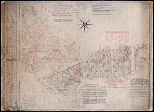
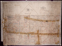
Plan of Township No. 58: Compiled from the proprietors plans and Meacham's Atlas, and from the…
Description: Plan of Lot 58 compiled from the proprietors' plans and Meacham's Atlas and from the descriptions in leases and registered deeds with additions and corrections from various surveys made… more
Province: Prince Edward Island
Type: cadastral maps
Date Created: 1916
Plan Shewing the Northern Boundary Line of the Victoria Park Roadway as Surveyed by Thomas W. May L…
Description: Plan showing the northern boundary line of the Victoria Park Roadway. This is the plan referred to in "The Victoria Park Roadway Act, 1896". Shown is the Charlottetown Harbour, Governor… more
Province: Prince Edward Island
Type: cadastral maps
Date Created: 1896

Plan Shewing the Eligible Situation of Acre Lots on the Estate of the Honble. J. C. Pope. in the…
Description: Plan showing the eligible situation of acre lots on the estate of Hon. J.C. Pope in the Royalty of the city of Charlottetown. Royalty Lots No.85, No.95 and No.97. (No.386)
Province: Prince Edward Island
Type: cadastral maps
Date Created: 1878
Holland Grove
Description: Plan of the block of land between Euston Street and Fitzroy Street and Prince Street and Great George Street known as Holland Grove. Town Lots 18-22 and 63-67 in the fifth hundred.
Province: Prince Edward Island
Type: cadastral maps
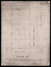
Plan A. Of 4 Pleasantly Situated Building Lots, fronting on Upper Prince Street, The property of…
Description: Plan "A" of four pleasantly situated lots fronting on Upper Prince Street, the property of the Hon. T.H. Haviland, Common Lot No.24. (No.60) more
Province: Prince Edward Island
Type: cadastral maps
Date Created: 1886

Plan of St. Avard's divided into Building Lots part of the Estate of the Honble. James C. Pope…
Description: Plan of St. Avards divided into building lots, part of the estate of the Hon. James C. Pope in the Royalty of Charlottetown. Royalty Lot No.13. Also shown are St. Peters Road, and Mt. Stewart Road.
Province: Prince Edward Island
Type: cadastral maps
Date Created: 1878

Plan showing the situation of part of the Estate of the late Owen Connolly Esq. in Charlottetown…
Description: Plan showing the situation of part of the Estate of the late Owen Connolly in Charlottetown Common and Royalty. Created by John Ball, surveyor, and copied by Thomas W. May. The map shows Malpeque… more
Province: Prince Edward Island
Type: cadastral maps
Date Created: 1921-01

Plan of 1390 Acres of Land part of Township No. 65: The property of the Hon,, Smauel Cunard…
Description: Plan of part of Lot 65 (No.172). 1390 acres of land, part of the property of the Hon. Samuel Cunard. One of the plans referred to in the Deed from Sir Edward, William, and Laura Cunard to the… more
Province: Prince Edward Island
Type: cadastral maps
Date Created: 1866-07-13
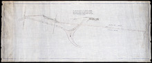
Plan of an approximate correction of the Junction of the Maitland road with the Murray Harbour Road…
Description: Plan of an approximate correction of the Junction of the Maitland Road with the Murray Harbour Road as sketched in sundry plans by the late Roderick Campbell... and as measured on the ground on the… more
Province: Prince Edward Island
Type: cadastral maps
Date Created: 1921-09-09
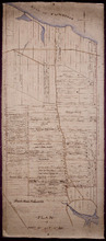
Plan of Lot or Township No. 58: Copied from Surveys of Rodk. Campbell. L. S. by Owen Curtis. L. S.
Description: Plan of Lot 58 (No.155). Shows names of residents, acreage, and land conveyance references. Surveyed by Rod'k Campbell and copied by Owen Curtis. The map shows roads, and bodies of water such as… more
Province: Prince Edward Island
Type: cadastral maps
Plan of that part of Township Number Forty-nine, in Prince Edward Island, the Property of the Hon.…
Description: Plan of part of Lot 49, the property of the Hon. Edward C. Haythorne and Robert Poore Haythorne. Tracts shaded green sold with the Act 28 Vic. Cap.5. (No.133). Shows names of residents and acreage,… more
Province: Prince Edward Island
Type: cadastral maps
Date Created: 1857-01
Plan of the eastern part of Lot 48 and the southern part of Lot 36
Description: Plan of the eastern part of Lot 48 and the southern part of Lot 36. Area around the Monaghan Road. Shows names of residents. (No.132)
Province: Prince Edward Island
Type: cadastral maps
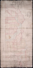
A Map and Survey Of Marshes east of Mount Stewart Bridge on the north side of Hillsborough River in…
Description: A map and survey of marshes east of Mount Stewart Bridge on the north side of Hillsborough River in Lot 37 being formerly part of the Wiggin's Estate. (No.21). Also shown is the Hillsborough… more
Province: Prince Edward Island
Type: cadastral maps
Date Created: 1885-01
A Plan of Glenaladale, The property of the Heirs of the late Honbl. Donald McDonald
Description: Plan of part of Lot 36 (No.98), Glenaladale, the property of the Heirs of the late Hon. Donald McDonald. Shows names of residents, acreage, and a few land conveyance references, bodies of water such… more
Province: Prince Edward Island
Type: cadastral maps
Date Created: 1856
Plan of that part of Township No. Thrity five in Prince Edward Island known by the name of the…
Description: Plan of part of Lot 35 (No.93). Known by the name of Glenfinn Estate, the property of the Heirs of the late Alexander McDonell of Donaldston containing an area of 1609 acres. The map shows roads, and… more
Province: Prince Edward Island
Date Created: 1859-12
Plan of a part of Township Number Thirty Five (35) on the south side of the Hillsborough River.
Description: Plan of Lot 35, south side of the Hillsborough River (No.92). Shows names of residents, acreage, and some land conveyance references, river, and roads.
Province: Prince Edward Island
Type: cadastral maps
Plan of the city of Charlottetown
Description: Plan of the city of Charlottetown. Shows the location of the 1st to the 5th Hundred and the Town Lots situated thereon.
Province: Prince Edward Island
Type: cartograms map
Plan shewing the situation of Malcolm Levingstone's Farm on Lot or Township No. 31, in…
Description: Plan of part of Lot 31. The map shows Malcolm Levingstone's farm of 56 ½ acres, coloured green, on the Baltic Road in Lot 31. The plan also shows the adjoining parcels of land and those on the… more
Province: Prince Edward Island
Type: cadastral maps
Date Created: 1865-12-26
Plan of the property of Mrs. S.W. Smith situated on Township No. 33 in Prince Edward Island
Description: Plan of part of Lot 33. The property of Mrs S.W. Smith. The map shows Winter River, and roads (Brackley Point), (Union), and a compass.
Province: Prince Edward Island
Type: cadastral maps
Plan Shewing the situation of that part of Water Lot No. 7. at Charlottetown Sold to Henry Beer Esq.
Description: Plan showing the situation of that part of Water Lot No.7 at Charlottetown sold to Henry Beer. (No.26) (Also No.216 Queens County). The map shows streets such as Great George, Prince, Water, wharfs,… more
Province: Prince Edward Island
Type: cadastral maps
Date Created: 1881
Plan Shewing the situation of Water Lot No. 8, and that part of Water Lot No. 7 conveyed to Ronald…
Description: Plan showing the situation of Water Lot No.8 and that part of Water Lot No.7 conveyed to Ronald MacMillan. The map also shows streets such as Water street, Prince, lots, Ferry Wharf, and Hillsborough… more
Province: Prince Edward Island
Type: cadastral maps
Plan of part of Charlottetown showing Pownal Wharf and Lot No.5
Description: Plan of part of Charlottetown showing Pownal Wharf and part of Town Lot No.5 located in 1st Hund. Also shown are buildings and wharfs.
Province: Prince Edward Island
Date Created: 1868-08
Plan of Township No. 20
Description: Plan of the western moiety of Lot 20 (No.50). Copy of the plan deposited by vendors of the Cunard Estate. The map also shows bodies of water such as rivers, creeks, and ponds, and roads.
Province: Prince Edward Island
Type: cadastral maps
Plan of the Western Moiety of Township, No. 20. Situate in Grenville Parish. Queens Co. P.E.Island…
Description: Plan of the Western Moiety of Lot 20 situate in Grenville Parish (No.49). Includes that part of Lot 20 south of the South West River. Shows names of residents and acreage, bodies of water such as… more
Province: Prince Edward Island
Type: cadastral maps
Eastern Moiety of Township No. 20
Description: Plan of the eastern moiety of Lot 20. Color code shows property of William Cundall, Louisa Montgomery, Eliza M. Cundall and Henry J. Cundall. Cundall Estate (No.51). Shows names of residents and… more
Province: Prince Edward Island
Type: cadastral maps
Plan of the French Marsh: Lot 37 - No. 10
Description: Plan of part of Lot 37 (Nos. 10 and 58). This item consists of three maps on three separate sheets, all showing the same area. The maps show the French Marsh on the north side of the Hillsborough… more
Province: Prince Edward Island
Type: cadastral maps, topographic maps
A Plan of Ronald McDonalds Land of Grand Tracadie For The Surveyors Generals Office
Description: Plan of part of Lot 35 (No. 5). The map shows 175 acres of land belonging to Ronald McDonald at Grand Tracadie in the northern part of Lot 35. The map shows the names of the residents on either side… more
Province: Prince Edward Island
Type: cadastral maps
Date Created: 1824-08-03
Plan of part of Lot 21: No. 55
Description: The map shows the southern portion of Lot 21 divided into parcels of land with the names of resident and their acreage amounts. Some parcels are outlined in red. Land conveyance information appears… more
Province: Prince Edward Island
Type: cadastral maps
Plan of part of Township No. 21 Grenville Parish, Queens County P.E.Island: H.J. Cundall delt 1850
Description: Plan of the northern part of Lot 21 (No.56). Cunard Estate. One of the plans referred to in the deed from Sir Edward, William, and Laura Cunard to the Commissioner of Public Land, July 13, 1866.… more
Province: Prince Edward Island
Type: cadastral maps
Date Created: 1850
Plan of part of Township No. 21: Copied from a Plan of H,J, Cundall's
Description: Plan of the northern part of Lot 21 (No.57). Cunard Estate. Shows names of residents, acreage, and some land conveyance references, bodies of water such as rivers, and the Gulf of Saint Lawrence,… more
Province: Prince Edward Island
Type: cadastral maps
Part of Township No. 21: in Prince Edward Island
Description: Plan of the southern half of Lot 21. One of the plans referred to in the Deed from Sir Edward, William and Laura Cunard to the Commissioner of Public Land, July 13, 1866. Shows names of residents,… more
Province: Prince Edward Island
Type: cadastral maps
Plan of Part of Lot No. 23
Description: Plan of the northern part of Lot 23 (No.62). Hodgson Estate. Shows names of residents and acreage, Gulf of St. Lawrnce, creeks, rivers, and roads. Color code indicates free and leased land.
Province: Prince Edward Island
Type: cadastral maps

Plan of the Estate of D.S. Rennie Esqr. on Lot No. 23 in Queens County Prince Edward Island: As…
Description: The map shows a southern portion of Lot 23 divided into numbered parcels of land with the names of residents and their acreage amounts. Some parcels are coloured green. The map also shows the land… more
Province: Prince Edward Island
Type: cadastral maps
Date Created: 1863
Plan of Township No. 23
Description: Plan of Lot 23. Shows the estates of Susan Rennie, David S. Rennie and Daniel Hodgson. Gives names of residents, acreage, and a few land conveyance references, rivers, gulfs, roads, towns, and a… more
Province: Prince Edward Island
Type: cadastral maps

Plan of Part of Lot or Township No.23 in grenville Parish in Queens County, Prince Edward Island
Description: Plan of part of Lot 23 (No.61). The estate of David Rennie. Shows names of residents, acreage, and some land conveyance references, rivers, and roads.
Province: Prince Edward Island
Type: cadastral maps
Date Created: 1864-05
Plan Shewing the situation of the respective Fishing Establishments, Fronting Harris or Rustico Bay…
Description: Plan of part of Lot 24. Shows situation of the fishing establishments fronting Harris or Rustico Bay. From actual survey. The map shows the Harbours Mouth and Robinsons Island.
Province: Prince Edward Island
Type: cadastral maps
Date Created: 1869-09-02
A Plan of Part of Lot No. XXVII Situat in P.E.I. the Property of J. Cambridge Esq. from an Actual…
Description: Plan of part of Lot 27 (No.74). The property of J. Cambridge. Shows names of residents and acreage, Carlton Cove and a compass. Plan is one of those referred to in the Deed from Sir Edward, William… more
Province: Prince Edward Island
Type: cadastral maps
Date Created: 1828-08
Plan of the Western Moriety of Township No. 29: The Estate of The honorable Lady Fane
Description: Plan of the western moiety of Lot 29 (No.78). The estate of the Hon. Lady Fane. Shows names of residents, acreage, and a few land conveyance references, bodies of water such as the Gulf of St.… more
Province: Prince Edward Island
Type: cadastral maps
A Plan of the Western Moriety of Township Number 29: The property of Colonel The Hon. H.S. Fane…
Description: Plan of the western moiety of Lot 29 (No.81). Property of Colonel the Hon. H.S. Fane. Shows names of residents, acreage, and roads. Signed by Owen Curtis, Land Surveyor.
Province: Prince Edward Island
Type: cadastral maps
Charlottetown Prince Edward Island: Population: 12,500. July 1903
Description: This item, the first of 20 pages of fire insurance maps of Charlottetown, serves as the key plan for the other Charlottetown pages. It was created in 1903, revised to 1910 and revised again to 1917.… more
Publisher: Chas. E. Goad, Civil Engineer
Province: Prince Edward Island
Type: fire insurance maps
Date Created: 1903-07
Date Modified: 1910-08, 1917-07
Date Issued (Source): 1888
Charlottetown, Prince Edward Island: July 1917. Reprinted
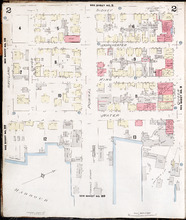
Description: This is Page 2 of 20 pages of fire insurance maps of Charlottetown. It shows the area from Sidney Street to the waterfront, between Haviland and Queen streets. The map shows numbered city blocks and… more
Publisher: Chas. E. Goad, Civil Engineer
Province: Prince Edward Island
Type: fire insurance maps
Date Created: 1917-07
Date Issued (Source): 1888
Charlottetown, Prince Edward Island: July 1917. Reprinted
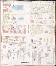
Description: This is Page 3 of 20 pages of fire insurance maps of Charlottetown. It shows the area from Sidney Street to the waterfront, between Queen and Prince streets. The map shows numbered city blocks and… more
Publisher: Chas. E. Goad, Civil Engineer
Province: Prince Edward Island
Type: fire insurance maps
Date Created: 1917-07
Date Issued (Source): 1888
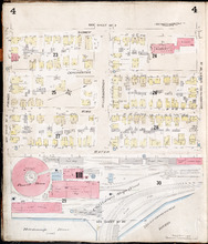
Charlottetown, P.E.I.: July 1903
Description: This is Page 4 of 20 pages of fire insurance maps of Charlottetown. It was created in 1903 and revised to either 1910 or 1917. The map shows the area from Sidney Street to the waterfront, between… more
Publisher: Chas. E. Goad, Civil Engineer
Province: Prince Edward Island
Type: fire insurance maps
Date Created: 1903-07
Date Modified: 1910-08, 1917-07 (year and month uncertain)
Date Issued (Source): 1888
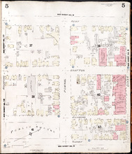
Charlottetown, P.E.I.: July 1917. Reprinted
Description: This is Page 5 of 20 pages of fire insurance maps of Charlottetown. It shows the area from Kent Street to Sidney Street, between Rochford and Queen streets. The map shows numbered city blocks and the… more
Publisher: Chas. E. Goad, Civil Engineer
Province: Prince Edward Island
Type: fire insurance maps
Date Created: 1917-07
Date Issued (Source): 1888
Charlottetown, P.E.I.: July 1903.
Description: This is Page 6 of 20 pages of fire insurance maps of Charlottetown. It was created in 1903 and revised to either 1910 or 1917. The map shows the area from Kent Street to Sidney Street, between Queen… more
Publisher: Chas. E. Goad, Civil Engineer
Province: Prince Edward Island
Type: fire insurance maps
Date Created: 1903-07
Date Modified: 1910-08, 1917-07 (year and month uncertain)
Date Issued (Source): 1888
Charlottetown, P.E.I.: July 1903.
Description: This is Page 7 of 20 pages of fire insurance maps of Charlottetown. It was created in 1903 and revised to either 1910 or 1917. The map shows the area from Kent Street to Sidney Street, between Prince… more
Publisher: Chas. E. Goad, Civil Engineer
Province: Prince Edward Island
Type: fire insurance maps
Date Created: 1903-07
Date Modified: 1910-08, 1917-07 (year and month uncertain)
Date Issued (Source): 1888
Charlottetown, P.E.I.: July 1903
Description: This is Page 8 of 20 pages of fire insurance maps of Charlottetown. It was created in 1903 and revised to either 1910 or 1917. It shows the area from Churchill Avenue and Chestnut Street to Kent… more
Publisher: Chas. E. Goad, Civil Engineer
Province: Prince Edward Island
Type: fire insurance maps
Date Created: 1903-07
Date Modified: 1910-08, 1917-07 (year and month uncertain)
Date Issued (Source): 1888
Charlottetown, P.E.I.: July 1903.
Description: This is Page 9 of 20 pages of fire insurance maps of Charlottetown. It was created in 1903 and revised to either 1910 or 1917. It shows the area from Passmore Street to Kent Street, between Queen and… more
Publisher: Chas. E. Goad, Civil Engineer
Province: Prince Edward Island
Type: fire insurance maps
Date Created: 1903-07
Date Modified: 1910-08, 1917-07 (year and month uncertain)
Date Issued (Source): 1888
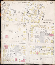
Charlottetown P.E.I.: July 1903
Description: This is Page 10 of 20 pages of fire insurance maps of Charlottetown. It was created in 1903 and revised to either 1910 or 1917. It shows the area from just north of Euston Street, south to Kent… more
Publisher: Chas. E. Goad, Civil Engineer
Province: Prince Edward Island
Type: fire insurance maps
Date Created: 1903-07
Date Modified: 1910-08, 1917-07 (year and month uncertain)
Date Issued (Source): 1888
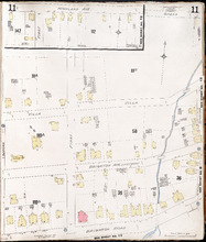
Charlottetown P.E.I.: July 1917. Reprinted
Description: This item, Page 11 of 20 pages of fire insurance plans of Charlottetown, consists of two (2) maps. The main map shows the area from Green Street to Brighton Road, between Greenfield Avenue (Second)… more
Publisher: Chas. E. Goad, Civil Engineer
Province: Prince Edward Island
Type: fire insurance maps
Date Created: 1917-07
Date Issued (Source): 1888
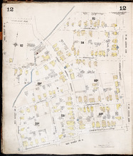
Charlottetown P.E.I.: July, 1903.
Description: This is Page 12 of 20 pages of fire insurance maps of Charlottetown. It was created in 1903 and revised to either 1910 or 1917. It shows the area from Douglas Street to Churchill Avenue and Chestnut… more
Publisher: Chas. E. Goad, Civil Engineer
Province: Prince Edward Island
Type: fire insurance maps
Date Created: 1903-07
Date Modified: 1910-08, 1917-07 (year and month uncertain)
Date Issued (Source): 1888
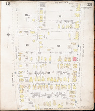
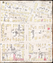
Charlottetown P.E.I.: July, 1903.
Description: This is Page 13 of 20 pages of fire insurance maps of Charlottetown. It was created in 1903 and revised to either 1910 or 1917. It shows the area bounded by Connolly Street in the north, Elm Avenue/… more
Publisher: Chas. E. Goad, Civil Engineer
Province: Prince Edward Island
Type: fire insurance maps
Date Created: 1903-07
Date Modified: 1910-08, 1917-07 (year and month uncertain)
Date Issued (Source): 1888
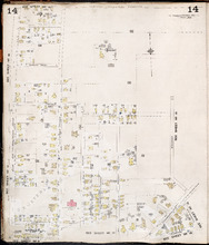
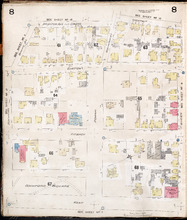
Charlottetown P.E.I.: July, 1903.
Description: This is Page 14 of 20 pages of fire insurance maps of Charlottetown. It was created in 1903 and revised to either 1910 or 1917. It shows the area from Allan (Allen) Street, in the north, to (… more
Publisher: Chas. E. Goad, Civil Engineer
Province: Prince Edward Island
Type: fire insurance maps
Date Created: 1903-07
Date Modified: 1910-08, 1917-07 (year and month uncertain)
Date Issued (Source): 1888
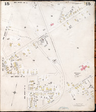
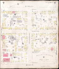
Charlottetown, P.E.I.: July, 1903.
Description: This is Page 15 of 20 pages of fire insurance maps of Charlottetown. It was created in 1903 and revised to either 1910 or 1917. The map shows part of the eastern portion of early twentieth-century… more
Publisher: Chas. E. Goad, Civil Engineer
Province: Prince Edward Island
Type: fire insurance maps
Date Created: 1903-07
Date Modified: 1910-08, 1917-07 (year and month uncertain)
Date Issued (Source): 1888
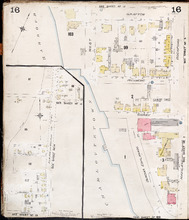
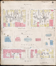
Charlottetown P.E.I.: July 1903
Description: This is Page 16 of 20 pages of fire insurance maps of Charlottetown. It was created in 1903 and revised to either 1910 or 1917. It contains two (2) maps, showing two (2) different areas of the city.… more
Publisher: Chas. E. Goad, Civil Engineer
Province: Prince Edward Island
Type: fire insurance maps
Date Created: 1903-07
Date Modified: 1910-08, 1917-07 (year and month uncertain)
Date Issued (Source): 1888
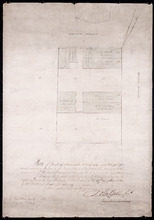
Plan of part of Town Lots Nos. 54 and 55, and Nos. 91 and 92 in the 2nd Hundred of Town Lots in…
Description: Plan of part of Town Lots Nos. 54 and 55, and Nos. 91 and 92 in the 2nd Hundred of Town Lots in Charlottetown agreeably to the possession of the Misses Stewart according to the original survey of the… more
Province: Prince Edward Island
Type: cadastral maps
Date Created: 1860-07-25

Plan of Lot 48 (No.2)
Description: Plan of Lot 48 (No.2). Shows property of Peter Stewart, Tho. Wright, Tho. DesBrisay, Chas. Stewart, and James Park. Also shows property leased to R. Stewart. Gives location of Battery and the acreage… more
Province: Prince Edward Island
Type: cadastral maps
Incomplete part of Lot 48 (No.130)
Description: Incomplete part of Lot 48 (No.130). Shows the following estates: DesBrisay, Crooke, Cummingham, Cunard, and Lawton. Also gives the names of some residents.
Province: Prince Edward Island
Type: cadastral maps
Plan of the southwestern part of Lot 48 (No.3)
Description: Plan of the southwestern part of Lot 48 (No.3). Gives names of some residents. Shows the location of York Battery and the Reserved Land at Crab Point.
Province: Prince Edward Island
Type: cadastral maps
Map of Lot Forty-Eight: J.H. Meachams and Co. Atlas
Description: Map of Lot 48. Draft for Meacham's Atlas. Also includes inset map of Southport or Stratford (scale: 6 chains/inch). Shows the Charlottetown Royalty, bodies of water such as rivers, and lakes,… more
Province: Prince Edward Island
Type: cadastral maps
Plan of Lots 49 and 50 showing Loyalist Shares drawn for in Council, 12 February, 1784.
Description: Plan of Lots 49 and 50 showing Loyalist Shares drawn for in Council, 12 February, 1784. Shown are lots and measurements.
Province: Prince Edward Island
Type: cadastral maps
Plan of a Part of Township No. 35 on the South Side of the Hillsborough River: Those portions…
Description: Plan of part of Lot 35 on the south side of the Hillsborough River showing the property of Rev. John Alister Somerlet MacDonald. Copied from a tracing by W.C. Harris in the Land Office (Plan No.3).… more
Province: Prince Edward Island
Type: cadastral maps
Date Created: 1878

Partial plan of Lot 48
Description: Partial plan of Lot 48. Mainly outline. Shows names of some residents in southern half of Lot. The map shows residents and lots, and roads.
Province: Prince Edward Island
Type: cadastral maps

Plan of Lot 49
Description: Plan of Lot 49 (No.6). Outline.
Province: Prince Edward Island
Type: cadastral maps

Plan showing the situation of the line of road from Melville Road to Appin Road also the connecting…
Description: Plan showing the situation of the line of road from Melville Road to Appin Road; also, the connecting road leading to Crapaud Wharf. Roads pass through Lots 29 and 30. (No.15, Queen's). Shown… more
Province: Prince Edward Island
Type: cadastral maps
Date Created: 1868-06-08

Plan of New Line Road from South Wiltshire Road Lot 31 to Emyvale Road Lot 65
Description: Plan of new line of road from South Wiltshire Road, Lot 31, to Emyvale Road, Lot 65. The map shows lots, roads, and residents.
Province: Prince Edward Island
Type: cadastral maps
Date Created: 1892-12-29
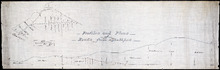
Profiles and plans of roads from Southport
Description: Profiles and plans of roads from Southport. (No.10) The map shows roads, lots, residents, and acreage.
Province: Prince Edward Island
Type: cadastral maps
Plan of proposed road from Winsloe Road to Brackley Point Road touching at Roy; Junc; Station
Description: Plan of proposed road from Winsloe Road to Brackley Point Road touching at Royalty Junction Station. Lot 33. (No.28) The map shows lots, roads, and residents.
Province: Prince Edward Island
Type: cadastral maps
Plan from French Village Road to Anderson Road
Description: Plan of road from French Village Road to Anderson Road. Lot 37. (No.8; also No.1 Queen's Co.) The map shows lots, roads, residents, and foliage. more
Province: Prince Edward Island
Type: cadastral maps
Section Shewing the Elevations of the Prince Toen Road from Hunter River to the Junction Road.
Description: Plan showing the elevations of the Prince Town Road from Hunter River to the Junction Road.
Province: Prince Edward Island
Type: cadastral maps
Plan Shewing the Malpeque Road from Charlottetown Royalty to Murrays: also the intended new line of…
Description: Plan Showing the Malpeque Road from Charlottetown Royalty to Murrays, also the intended new line of Road to avoid the Hills as Shown by the dotted line. Also are roads, lots, and bodies of water.
Province: Prince Edward Island
Type: cadastral maps

Plan of Town Lots No.74 and No.75 in the 4th Hundred of Town Lots in the city of Charlottetown with…
Description: Plan of Town Lots No.74 and No.75 in the 4th Hundred of Town Lots in the city of Charlottetown with the respective subdivisions delineated thereon. (No.64) Shown are lots and residents.
Province: Prince Edward Island
Type: cadastral maps
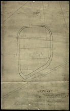
Plan of Race Course Charlottetown Royalty
Description: Plan of the Old Race Course in Charlottetown Royalty. (No.21). Shows lots and residents.
Province: Prince Edward Island
Type: cadastral maps

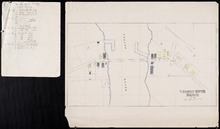
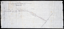
P.E.I. Railway Murray Harbour Branch: Plan of Spur Line and Ballast Pit at Surrey
Description: Prince Edward Island Railway. Murray Harbour Branch. Plan of Spur Line and Ballast Pit at Surrey (No.1159). Plan produced by H. Laurence, Engineer in Charge. Shown are roads, the railway, lots, and… more
Province: Prince Edward Island
Type: cadastral maps
Date Created: 1908-12-02

Plan of marsh lands on the two sides of the Pisquid River
Description: Plan of marsh lands on the two sides of the Pisquid River. Lot 37. (No.68, Queens Co.) The map shows lots, residents, measurements, and acerage.
Province: Prince Edward Island
Type: cadastral maps
Date Created: 1897-12
Plan of Lot 31
Description: Plan of Lot 31 (No.2). Mainly outline. Shows Refugee Share drawn for in Council, 12 February, 1784. Signed by John Russell Spence, Clerk of the Council.
Province: Prince Edward Island
Type: cadastral maps
Date Created: 1784

Prince Edward Island Railway Plan showing right of way of the Murray Harbour Branch through Queen…
Description: Prince Edward Island Railway Plan showing right of way of the Murray Harbour Branch through Queen's County from Village Green to Pisquid Road. (Plan No.6) The map shows lots, residents, railway… more
Province: Prince Edward Island
Type: cadastral maps

Plan of Lot 48
Description: Plan of Lot 48. Incomplete. Shows names of residents, acreage, and some land conveyance references for the eastern part of the lot, roads and bodies of water.
Province: Prince Edward Island
Type: cadastral maps