| Title Proper |
Vernon River Bridge, Lot 50
|
|---|---|
| Description |
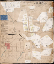
This item consists of a fire insurance plan of the community of Vernon River Bridge and an accompanying handwritten text document. The map of Vernon River shows the community divided into numbered sections and it shows buildings, coloured either yellow or blue/grey, with numbers assigned to them. Labels on some buildings indicate their use. The Vernon River is outlined with blue. The map has a north arrows. The single-sided text document lists the buildings by number and gives the names of their owners and/or their uses.
|
| Access Condition |
This material is provided for research, education, and private use only. For all other uses, please contact the Public Archives and Records Office of Prince Edward Island. All responsibilities for copyright are the responsibility of the user.
|
| Type | |
| Physical Location |
Public Archives and Records Office of P.E.I.
|
| Public Archives Number |
4458_s6
|
| Date Issued (Source) |
1888
|
| Extent |
1 ms. map: col.; 42 x 23.5 cm. (Sheet size: 43 x 35.5 cm.) and 1 text document: 16.5 x 21 cm.
|
| Physical Description |
Paper map with a paper text document (handwritten, single-sided). The map and the text document, attached to each other with a metal clip, sit loose inside the pages of a bound book of Prince Edward Island fire insurance maps issued by Chas. E. Goad.
|
| Scale |
2 chains/inch
|
| Geographic - Continent | |
| Geographic - Country | |
| Geographic - Province/State | |
| Geographic - County | |
| Geographic - Lot/Region | |
| Geographic - City | |
| Subject (Topical) | |
| Source |
Prince Edward Island
Creator: Chas. E. Goad, Civil Engineer
Publisher
Chas. E. Goad, Civil Engineer
Date Issued
1888
Public Archives Number
4458
|