Displaying 541 - 648 of 992
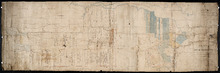
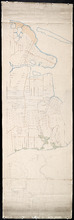
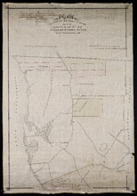
Plan of the Northern Moiety of Lot or Township No. 48 in Prince Edward Island, Copied from the Plan…
Description: Plan of the northern moiety of Lot 48 (No.129). Shows the property of Miss Frances Crooke, R.G. Cuninghame, Theo. Desbrisay, and the Misses Lawton. The map shows lots, residents, roads, and bodies of… more
Province: Prince Edward Island
Type: cadastral maps
Date Created: 1836

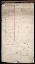
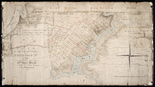
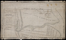
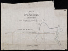
Plan of Township No. 50 The Estate of the Misses[?] Fanning, Prince Edward Island: From actual…
Description: Plan of Lot 50. Fanning Estate. The map shows lots, residents, bodies of water and roads.
Province: Prince Edward Island
Type: cadastral maps
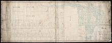
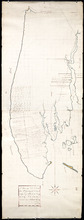
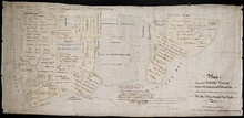
A Plan of the Eastern or C Division of Lot or Township No. 51: St. Georges Parish, Kings Coutnry, P…
Description: Plan of the eastern division of Lot 51. Montgomery Estate. The map shows the C Division of Lot 51 divided into numbered parcels of land with the names of owners or occupants with their corresponding… more
Province: Prince Edward Island
Type: cadastral maps
Plan of Lot or Township No. 51 in Kings County Prince Edward Island: Surveyed by G. Wright Jr. in…
Description: Plan of Lot 51 (No.141). Shows residents, lots, bodies of water such as rivers, and roads.
Province: Prince Edward Island
Type: cadastral maps
Date Created: 1836
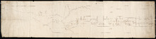
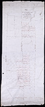
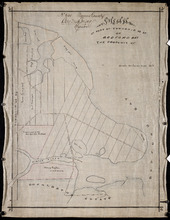
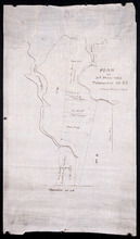
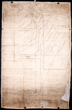
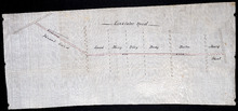
Plan of Lot 57
Description: Plan of Lot 57 (No.2) showing the lot divided into quarters. Also shows Refugee Share drawn for in Council, 12 February, 1784.
Province: Prince Edward Island
Type: cadastral maps
Date Created: 1784-02-12

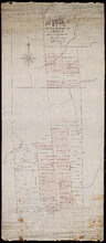
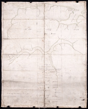
A Plan of the undisposed of Parts of Lot No. 57: in Queens County in Prince Edward Island
Description: A plan of the undisposed of parts of Lot 57. Surveyed by Rod'k Campbell. The map shows parcels of land with names of owners or occupants and their corresponding acreage amounts handwritten in… more
Province: Prince Edward Island
Type: cadastral maps
Date Created: 1860
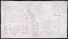
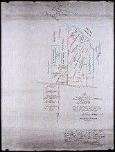
Plan of Lot 58
Description: Plan of Lot 58 divided into four sections. Shows Refugee Shares drawn for 12th February, 1784. Shown are lots, residents, and bodies of water.
Province: Prince Edward Island
Type: cadastral maps
Date Created: 1784-02-12

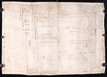
A Plan of the undisposed of Part, of Lot No. 38 in Queens County in Prince Edward Island
Description: A plan of the undisposed part of Lot 58 (No.154). Shows residents, lots, roads, and water. Surveyed by Rod'k Campbell. more
Province: Prince Edward Island
Type: cadastral maps
Date Created: 1860
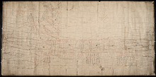
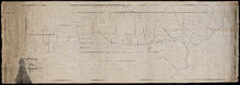
Plan of Lot or Township No 59: Two Thirds being the property of The Messrs Montgimeries being 13,…
Description: Plan of Lot 59 (No.157). Two thirds being the property of the Messrs. Montgomeries being 13,064 acres. One third, the property of Earl Selkirk. Plan copied by Jas. J. Bevan. Date of plan: April 1848… more
Province: Prince Edward Island
Type: cadastral maps
A Plan of the North or C Division of Lot or Township No. 59: Kings County, P. E. Island
Description: A plan of the north division of Lot 59 (No.159). James Montgomery Estate. The map shows the C Division of Lot 59 divided into numbered parcels of land with the names of occupants and their… more
Province: Prince Edward Island
Type: cadastral maps
Plan of Lot or Township No 59 Two Thirds being the property of Sir James Montgomery Brothers being…
Description: Plan of Lot 59. Two thirds being the property of Sir James Montgomery & Brothers, and one third the property of Earl Selkirk. The map shows bodies of water such as rivers, residents, lots, and… more
Province: Prince Edward Island
Type: cadastral maps
Date Created: 1842-03-01
Lot 50
Description: Plan of Lot 63 (No.2). The property of J. Cambridge. Mainly outline. Shows a few residents, lots, bodies of water, islands, and roads.
Province: Prince Edward Island
Type: cadastral maps
Date Created: 1829-04
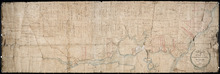
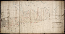
Plan of Township No 63, St. Andrews Parish Kings County: Prince Edward Island
Description: Plan of Lot 63. Eastern part shows names of residents, lots, acreage, bodies of water such as rivers, and bays, and roads.
Province: Prince Edward Island
Type: cadastral maps
Date Created: 1842
Plan of Township No 63 St. Andrew's Parish Queens County: P.E.Island
Description: Plan of Lot 63. This is one of the plans referred to in the Deed from the Cunards to the Commissioner of Public Lands, July 15, 1866. The map shows lots, residents, roads, acreage and bodies of water… more
Province: Prince Edward Island
Type: cadastral maps
Date Created: 1851
A Plan of Lot No 64: The property of J. Cambridge Esq Situate in Kings County P.E.Island
Description: Plan of Lot 64. The property of J. Cambridge. Shows some residents. Copy by James Richard. The map shows lots, residents, roads, cities, towns, and bodies of water.
Province: Prince Edward Island
Type: cadastral maps
Date Created: 1829-03
A Plan of Lot No. LXIV: The Property of J. Cambridge Esqr. Situate in Kings County P. E. Island…
Description: Plan of Lot 64 (No. 2). The property of J. Cambridge. The map shows Lot 64 partially divided into parcels of land with the names of residents and their acreage amounts. The map shows roads, which are… more
Province: Prince Edward Island
Type: cadastral maps
Date Created: 1829-03
Plan of Half Township No. 65 One of the Estates of the Misses Fanning - Prince Edward Island: From…
Description: Plan of the eastern half of Lot 65 (No. 175). The Misses Fanning Estate. The map shows lots, residents, roads, and bodies of water such as rivers.
Province: Prince Edward Island
Type: cadastral maps
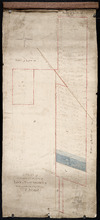
Plan of the Western Portion of Township No. 65: containing 5250 acres and belonging to Mrs. Lydia…
Description: Plan of the western portion of Lot 65 (No.173). Estate of Mrs Lydia Wright. Roads, leased land[?] and freehold land on the Estate of Mrs. Lydia Wright. Tenant names appear on the sub-lots, which are… more
Province: Prince Edward Island
Type: cadastral maps
Date Created: 1841
Plan of Lot or Township No. 66: from the latest Surveys by Jos. Ball Surveyor General's Office…
Description: Plan of Lot 66. Gives list of settlers. The map shows Lot 66 divided into numbered parcels of land. Along the side there is a corresponding list of parcel numbers and settlers' names handwritten… more
Province: Prince Edward Island
Type: cadastral maps
Date Created: 1856-08-04
Plan of Lot or Township No. 66 from actual survey.
Description: Plan of Lot or Township No. 66 from actual survey. Rolled paper on fabric backing; handwriting on verso. The map shows Lot 66 divided into parcels of land with the names of residents and their… more
Province: Prince Edward Island
Type: cadastral maps
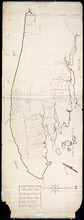
Plan of the Moiety of Lot or Township No 29 of the Estate of Viscount elville situated in Prince…
Description: Plan of the east moiety of Lot 29 (No.2). Part of the estate of Lord Viscount Melville. The map shows lots, residents, roads, and bodies of water such as rivers.
Province: Prince Edward Island
Type: cadastral maps
Plan Showing the situation of the Estate of Mr. Clement White on Lot or Township No. 32
Description: Plan of part of Lot 32 (No.21). The estate of Mr. Clement White. The map shows lots, residents, roads, and York (or North) River.
Province: Prince Edward Island
Type: cadastral maps
Date Created: 1874-01
Plan of the Property of Mrs Smith situate in Township No 33 in Prince Edward Island: Mrs S's…
Description: Plan of part of Lot 33 showing the property of Mrs. S.W. Smith. The map shows lots, residents, acreage, roads, and water.
Province: Prince Edward Island
Type: cadastral maps
Plan of the Property of Ms S W Smith Situate on Township No 33 in Prince Edward Island: Mrs S'…
Description: Plan of part of Lot 33, showing the property of Mrs. S.W. Smith. The map shows lots, residents, roads, and bodies of water such as rivers.
Province: Prince Edward Island
Type: cadastral maps
Plan of Lot 35
Description: Plan of Lot 35 (No.95). Shows some residents, lots, roads, bodies of water and foliage.
Province: Prince Edward Island
Type: cadastral maps
Part of Lot 35 in Queens county
Description: Plan of part of Lot 35 (No.631). The Estate of John A. MacDonald. Shows area around Johnston's River. Date of plan: post 1811, after the death of Captain MacDonald. The map shows lots, residents… more
Province: Prince Edward Island
Type: cadastral maps
Plan of part of Township Number 35 situate on the North side of the Hillsborough River.: Those…
Description: Plan of Lot 35 (No.1). North side of the Hillsborough River. Property of Rev. John MacDonald. From a tracing by W.C. Harris. The map shows lots, residents, roads, and bodies of water.
Province: Prince Edward Island
Type: cadastral maps
Date Created: 1878-03-21
Plan of Part of Township no 35 on Bedford Bay
Description: Plan of part of Lot 35 (No.631) bordering on Bedford Bay. The map shows lots, residents, roads, and various bodies of water.
Province: Prince Edward Island
Type: cadastral maps
Plan of Part of Township No. 35 on the North Side of the Hillsborough River
Description: Plan of part of Lot 35 on the north side of the Hillsborough River. The map shows lots, residents, roads, Bedford Bay and foliage.
Province: Prince Edward Island
Type: cadastral maps
Plan of Part of Township No. 35 situate on the South Side of the Hillsborough River
Description: Plan of part of Lot 35 situate on the south side of the Hillsborough River. The property of John Apollinarius MacDonnell. Plan copied by R.T. Weeks. The map shows lots, residents, roads, islands, and… more
Province: Prince Edward Island
Type: cadastral maps
Plan of St Martins Township No 35
Description: Plan of part of Lot 35, St. Martins. The map shows lots, residents, and bodies of water such as rivers.
Province: Prince Edward Island
Type: cadastral maps
Plan if the Southren Moiety of Township No 36 Part of the Estate of the Rev: John Alister Somerlet…
Description: Plan of the southern moiety of Lot 36 (No.2). Part of the estate of the Rev. John Alister Somerlet MacDonald. From a tracing by W.C. Harris. The map shows lots, residents, a pond, and roads.
Province: Prince Edward Island
Type: cadastral maps
Date Created: 1878-03-22
Plan of Lot 37
Description: Plan of Lot 37, north of the Hillsborough River. Shows some residents, lots, roads, and bodies of water.
Province: Prince Edward Island
Type: cadastral maps
Surveyor General's Plan for south western half of Lot 37
Description: Surveyor General's Plan for south western half of Lot 37 (No.1). The map shows lots, residents, and bodies of water. more
Province: Prince Edward Island
Type: cadastral maps
Plan of part of Lot 38
Description: Plan of part of Lot 38 (No.7). Part of Mrs. Burns' property, sold to LeLacheur and others. The map shows lots, and residents. more
Province: Prince Edward Island
Type: cadastral maps
Plan of the estates of the late Angus McDonald and James McDonald at Springfield Township No 39:…
Description: Part of Lot 39. Plan of the estates of the late Angus McDonald and James McDonald at Springfield. Also the subdivisions of the same as agreed upon at the time of survey. The map shows lots, residents… more
Province: Prince Edward Island
Type: cadastral maps
Date Created: 1910-09
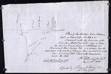
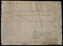
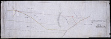
Plan of the division line between Lots 59 and 61, surveyed under the provisions of the Boundary…
Description: Plan of the division line between Lots 59 and 61, surveyed under the provisions of the Boundary Bill 4 William 4 Cap.15. This copy is taken from an original plan created 15 August 1838 by surveyor… more
Province: Prince Edward Island
Type: cadastral maps
Date Created: 1838-08-15
Date Modified: 1908-02
Plan of the division line between Lots 48 and 49
Description: Plan of the division line between Lots 48 and 49. The map shows lots, residents, roads, and bodies of water.
Province: Prince Edward Island
Type: cadastral maps
Date Created: 1841-06
Plan of the division line between Lots 31 and 65, the commencement of which was set by the…
Description: Plan of the division line between Lots 31 and 65, the commencement of which was set by the Commissioners for establishing boundary lines. (No.1) The map shows lots, roads, and rivers.
Province: Prince Edward Island
Type: cadastral maps
Date Created: 1837-08-26
Royalty of Charlotettown
Description: Plan showing the line dividing Lots 33 and 34. (No.10). The map shows lots, residents, roads, and bodies of water.
Province: Prince Edward Island
Type: cadastral maps
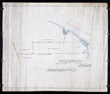
Plan showing the point of commencement of the division line between Lots 48 and 49, established by…
Description: Plan showing the point of commencement of the division line between Lots 48 and 49, established by the Commissioners under the Boundary Bill, July 30, 1840. The map shows lots, residents, roads,… more
Province: Prince Edward Island
Type: cadastral maps
Date Created: 1840-08
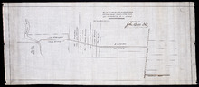
Plan of a New Road from the Flat River Road (marked A, B, C, D, E, F.) to the shore of the straits…
Description: Plan of a New Road from the Flat River Road to the shore of the straits. On Lots 60 and 62. The map shows lots, residents, roads, and water.
Province: Prince Edward Island
Type: cadastral maps
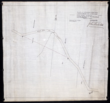
Plan shewing the situation of a new line of road from Baldwin's Road, Lot 51 to Brother's…
Description: Plan showing the situation of a new line of road from Baldwin's Road, Lot 51 to Brother's Road, Lot 66 more
Province: Prince Edward Island
Type: cadastral maps
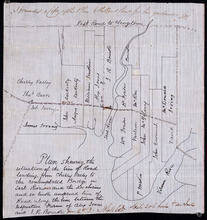
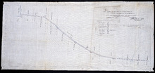
Plan shewing the situation of the line of road leading from Cherry Valley to the contemplated…
Description: Plan showing the situation of the line of road leading from Cherry Valley to the contemplated bridge on Seal River and the 24 chains and 50 links unopened line of road along the line between the… more
Province: Prince Edward Island
Type: cadastral maps
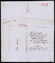
Plan of part of the Georgetown Road on Lot 51 showing the encrouchment by John Curran from a survey…
Description: Plan of part of the Georgetown Road on Lot 51. Shows Union Road and property of John Curran. (No.3) The map shows lots, resident, and roads.
Province: Prince Edward Island
Type: cadastral maps
Date Created: 1908-06-04
Plan of the road from Kelly's Cove to the line between John F. Baker and Frank Bovyer thro…
Description: Plan of the road from Kelly's Cove to the line between John F. Baker and Frank Bovyer through Bunbury, Lot 48. Ordered to be widened. The map shows lots, residents, roads, and water. more
Province: Prince Edward Island
Type: cadastral maps
Plan of proposed new road straightening Rollo Bay Road, through the farms of Chas. Townshend and…
Description: Plan of proposed new road straightening Rollo Bay Road, through the farms of Chas. Townshend and Jos. Webster. The map shows lots, residents, and roads.
Province: Prince Edward Island
Type: cadastral maps
Proposed New Road from Rustico Road to Brookfield Road
Description: Proposed New Road from Rustico Road to Brookfield Road. The map shows lots, roads, residents, and a swamp.
Province: Prince Edward Island
Type: cadastral maps
Plan showing the position of 2 new lines of road from R. McMillan's Mills to Fredericton…
Description: Plan showing the position of 2 new lines of road from R. McMillan's Mills to Fredericton Station. Also through McMillan's land from French Settlement. Also from Trout River Bridge to Road… more
Province: Prince Edward Island
Type: cadastral maps

Plan of a proposed new line of road from Middleton Road to Isaac Ive's Millas coloured brown…
Description: Plan of a proposed new line of road from Middleton Road to Isaac Ive's Mill connecting with the road already opened from Searletown to Ive's Mill thro. part of Lot 27. The map shows lots,… more
Province: Prince Edward Island
Type: cadastral maps
Plan Shewing the Situation of the Presen road from Point Prim Also the proposed road A.B.C.orD.
Description: Plan showing the situation of the present road from Point Prim. Also, the proposed one. The map shows lots, residents, water and foliage.
Province: Prince Edward Island
Type: cadastral maps
Plan of a new line of road from Victoria West to Western Road Lot 13 Prince Co. P.E.Island
Description: Plan of a new line of road from Victoria West to Western Road. Lot 13. The map shows lots, residents, roads, and rivers.
Province: Prince Edward Island
Type: cadastral maps
Plan of part of the Linklater Road, Lot 17
Description: Plan of part of the Linklater Road, Lot 17. (Linkletter Road) The map shows lots, residents, and roads.
Province: Prince Edward Island
Type: cadastral maps

Title Page
Description: Title page for the "Illustrated Historical Atlas of the province of Prince Edward Island From Surveys made under the direction of C. R. Allen, C.E." by J. H. Meacham more
Type: image
Date of Part: 1880
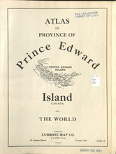
Title Page
Description: Title page of Atlas of Province of Prince Edward Island, Canada and the World
Publisher: Cummins Map Co.
Province: Prince Edward Island
Type: text
Date Issued (Source): 1927

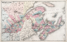
Geological Maps of the Maritime Province: of the Dominion of Canada
Description: The map shows the geology of the Maritime Province. Shown are provinces of New Brunswick, Nova Scoita and Cape Breton Island, Prince Edward Island, and Newfoundland as an insert. Other objects shown… more
Publisher: Roe Brothers
Province: Prince Edward Island, New Brunswick, Nova Scotia, Cape Breton Island
Type: geological maps
Date Issued (Source): 1878
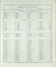
Table of Contents
Description: Table of Contents including the headings City, Town, and Village Maps, Lot and Royalty Maps, Portraits, and Views.
Type: text
Date of Part: 1880
Province of Prince Edward Island, Canada: Cummins Map Co. Toronto
Description: The map shows all of Prince Edward Island and some of New Brunswick and Nova Scotia. Shown through a table of Counties are bays, roads, marshes, rapids, Indian Reserves, Lighthouses, depth of water,… more
Publisher: Cummins Map Co.
Province: Prince Edward Island
Type: cadastral maps
Date Issued (Source): 1927
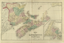
Map of the Maritime Provinces: of the Dominion of Canada
Description: The map shows the geology of the Maritime Province. Shown are provinces of New Brunswick, Nova Scoita and Cape Breton Island, Prince Edward Island, and Newfoundland as an insert. Other objects shown… more
Publisher: Roe Brothers
Province: Prince Edward Island, New Brunswick, Nova Scotia, Cape Breton Island
Type: geological maps
Date Issued (Source): 1878
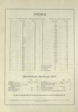
Index
Description: An index to the lots and rural directories found in the atlas as well as maps of Canadian provinces.
Publisher: Cummins Map Co.
Province: Prince Edward Island
Type: text
Date Issued (Source): 1927
Counties of Restigouche and Madawaska: New Brunswick
Description: The maps shows the counties of Restigouche and Madawaska. Shown are Resitgouche Harbour, cities, towns, and lakes.
Publisher: Roe Brothers
Province: New Brunswick
Type: geographical maps
Date Issued (Source): 1878
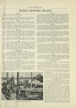
Prince Edward Island - 1
Description: The text provides information for the history, landscape, and various industries such as fishing on the island.
Publisher: Cummins Map Co.
Province: Prince Edward Island
Type: text
Date Issued (Source): 1927
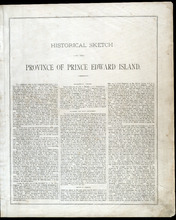
Historical Sketch of the Province of Prince Edward Island - Page 3
Description: The beginning of The Historical Sketch of Prince Edward Island, which cover such topics as Geographical Position, Discovery and Early Settlement, the Treaty of Utrecht, and French and English… more
Publisher: J. H. Meacham & company
Province: Prince Edward Island
Type: text
Date Issued (Source): 1880
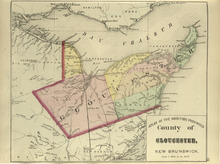
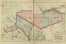
County of Gloucester: New Brunswick
Description: The map shows the county of Gloucester in New Brunswick. Shown are bays, railroads and stations, harbours, rivers, roads, towns and cities.
Publisher: Roe Brothers
Province: New Brunswick
Type: geological maps
Date Issued (Source): 1878
Prince Edward Island - 2
Description: The text provides information for the current events of the island in 1770's, the fur trade and Prince Edward Island's role in the European War. more
Publisher: Cummins Map Co.
Province: Prince Edward Island
Type: text
Date Issued (Source): 1927

Historical Sketch of the Province of Prince Edward Island - Page 4
Description: This portion of the historical sketch of P.E.I. includes information on various topics such as The Population of the Island, The Treaty of Fontainbleau and a list of lot owners, The Quit Rents,… more
Publisher: J. H. Meacham & company
Province: Prince Edward Island
Type: text
Date Issued (Source): 1880
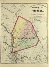
County of Victoria: New Brunswick
Description: The maps shows the county of Victoria in New Brunswick. Shown are rivers, brooks, Grand Falls, railroads and stations.
Publisher: Roe Brothers
Province: New Brunswick
Type: geographical maps
Date Issued (Source): 1878
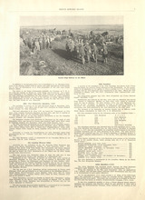
Prince Edward Island - 3
Description: The text provides information on the more specific details about Prince Edward Island's involvement in the European war, going into detail about the different battalions that were supported. more
Publisher: Cummins Map Co.
Province: Prince Edward Island
Type: text
Date Issued (Source): 1927
Historical Sketch of the Province of Prince Edward Island - Page 5
Description: This portion of the historical sketch of P.E.I. includes information on various topics such as The American War of Independence, Governors of the Island (Patterson, Fanning, Smith) and their… more
Publisher: J. H. Meacham & company
Province: Prince Edward Island
Type: text
Date Issued (Source): 1880
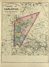
County of Carleton: New Brunswick
Description: The map shows the county of Carleton in New Brunswick. Shown are raods, railroads, towns, cities, and lakes.
Publisher: Roe Brothers
Province: New Brunswick
Type: geographical maps
Date Issued (Source): 1878
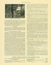
Prince Edward Island - 4
Description: The text provides information on the more specific details about Prince Edward Island's involvement in the European war, going into detail about the different battalions that were supported. more
Publisher: Cummins Map Co.
Province: Prince Edward Island
Type: text
Date Issued (Source): 1927
Historical Sketch of the Province of Prince Edward Island - Page 6
Description: This portion of the historical sketch of P.E.I. includes information on various topics such as Governors (Ready, Young, Huntley, Campbell, Bannerman), progress and population growth, the crowning of… more
Publisher: J. H. Meacham & company
Province: Prince Edward Island
Type: text
Date Issued (Source): 1880
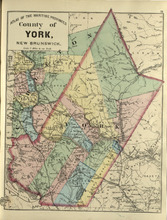
County of York: New Brunswick
Description: The map shows the county of York in New Brunswick. Shown are railroads and stations, St. Mary Ferry, Nashwaak Bridge, mills, lakes, MacAdam Junction, post offices, cities, and towns.
Publisher: Roe Brothers
Province: New Brunswick
Type: geographical maps
Date Issued (Source): 1878
Introduction to the Province of Prince Edward Island - 5 - Page 5
Description: Text provides a list of the different divisions in the 105th battalion and the men enlisted in each division from Prince Edward Island.
Publisher: Cummins Map Co.
Province: Prince Edward Island
Type: text
Date Issued (Source): 1927
Historical Sketch of the Province of Prince Edward Island - Page 7
Description: This portion of the historical sketch of P.E.I. includes information on various topics such as the Telegraph Cable between Cape Tormentine and Cape Traverse, treaties with the United States,… more
Publisher: J. H. Meacham & company
Province: Prince Edward Island
Type: text
Date Issued (Source): 1880
County of York: New Brunswick
Description: The map shows the county of York in New Brunswick. Shown are railroads and stations, St. Mary Ferry, Nashwaak Bridge, mills, lakes, MacAdam Junction, post offices, cities, and towns.
Publisher: Roe Brothers
Province: New Brunswick
Type: geographical maps
Date Issued (Source): 1878
Military Directory - 98th Siege Battery - Page 6
Description: A directory listing of enlisted men in the 98th Siege Battery from Prince Edward Island.
Publisher: Cummins Map Co.
Province: Prince Edward Island
Type: text
Date Issued (Source): 1927
Historical Sketch of the Province of Prince Edward Island - Page 8
Description: This portion of the historical sketch of P.E.I. includes information various topics such as Island Government, Confederation, the Tenant League, and the American Civil War (continued on page 9).
Publisher: J. H. Meacham & company
Province: Prince Edward Island
Type: text
Date Issued (Source): 1880
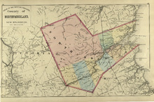
County of Northumberland: New Brunswick
Description: The map shows the county of Northumberland in New Brunswick. Shown are bays, lakes, rivers, railroads, towns, and cities.
Publisher: Roe Brothers
Province: New Brunswick
Type: geological maps
Date Issued (Source): 1878
Military Directory - 105th Battalion - 1
Description: A directory listing of officers and men enlisted in the 105th regiment of the 105th battalion from Prince Edward Island
Publisher: Cummins Map Co.
Province: Prince Edward Island
Type: text
Date Issued (Source): 1927
Historical Sketch of the Province of Prince Edward Island - Page 9
Description: This portion of the historical sketch of P.E.I. includes information regarding the Fenian Organization, Confederation, dealings with the United States, legislature, the telegraph, the Governor… more
Publisher: J. H. Meacham & company
Province: Prince Edward Island
Type: text
Date Issued (Source): 1880
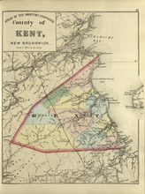
County of Kent: New Brunswick
Description: The map shows the county of Kent in New Brunswick. Shown are bays, rivers, mills, braches, Langhilins road, and Shediac Bridge.
Publisher: Roe Brothers
Province: New Brunswick
Type: geological maps
Date Issued (Source): 1878
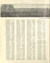
Military Directory - 105th Battalion - 2
Description: A directory listing of officers and men enlisted in the 105th regiment of the 105th battalion from Prince Edward Island
Publisher: Cummins Map Co.
Province: Prince Edward Island
Type: text
Date Issued (Source): 1927
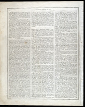
Historical Sketch of the Province of Prince Edward Island - Page 10
Description: This portion of the historical sketch of P.E.I. includes information under such subtitles as The Railroad Question and On the First Day of July, 1873. This page also includes information on the… more
Publisher: J. H. Meacham & company
Province: Prince Edward Island
Type: text
Date Issued (Source): 1880
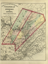
Counties of Sunbury and Queens: New Brunswick
Description: The map shows the counties of Sunbury and Queens in New Brunswick. Shown are railroads, stations and junctions, rivers, lakes, and creeks.
Publisher: Roe Brothers
Province: New Brunswick
Type: geological maps
Date Issued (Source): 1878
Military Directory - 105th Battalion - 3
Description: A directory listing of officers and men enlisted in the 105th regiment of the 105th battalion from Prince Edward Island
Publisher: Cummins Map Co.
Province: Prince Edward Island
Type: text
Date Issued (Source): 1927
Historical Sketch of the Province of Prince Edward Island - Page 11
Description: This portion of the historical sketch of P.E.I. includes information on the histories and populations of Lots 5 through 67, as well as information about the towns of Charlottetown, Georgetown, and… more
Publisher: J. H. Meacham & company
Province: Prince Edward Island
Type: text
Date Issued (Source): 1880
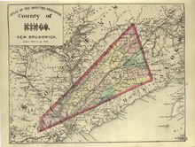
County of Kings, New Brunswick
Description: The map shows the county of Kings in New Brunswick. Shown are rivers, railroads and stations, roads, and lakes. Atlas of the Maritime Provinces of the Dominion of Canada with historical and… more
Publisher: Roe Brothers
Type: geographical maps
Date Issued (Source): 1878
Military Directory - 105th Battalion - 4
Description: A directory listing of officers and men enlisted in the 105th Regiment, No. 12 Reinforcement Draft Canadian Railway Troops, 28th Draft Canadian Railway Troops, and No. 5 Siege Battery of the 105th… more
Publisher: Cummins Map Co.
Province: Prince Edward Island
Type: text
Date Issued (Source): 1927
Biographical Sketches - Page 12
Description: Biographical sketches of the Hon. William Wilfred Sullivan Q.C., Hon. Neil McLeod, Hon. Donald Ferguson, Hon. Samuel Prowse, Hon. Joseph Wightman, Caleb Schurman Esq., Alfred McWilliams, Esq.,… more
Publisher: J. H. Meacham & company
Province: Prince Edward Island
Type: text
Date Issued (Source): 1880
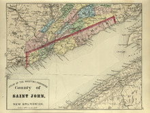
County of St. John, New Brunswick
Description: The map shows the county of St. John in New Brunswick. Shown are harbours, coves, rivers, railroads, towns, and cities. Atlas of the Maritime Provinces of the Dominion of Canada with historical and… more
Publisher: Roe Brothers
Type: geographical maps
Date Issued (Source): 1878
Military Directory - 105th Battalion - 5
Description: A directory listing of of officers and men draft enlisted for No. 5 Siege Battery, drafted for 10th Battalion, recruited for the Navy, and killed in action from Prince Edward Island
Publisher: Cummins Map Co.
Province: Prince Edward Island
Type: text
Date Issued (Source): 1927
Biographical Sketches - Page 13
Description: Biographical sketches of John C. Leitch Esq., George Mutch Esq., Duncan Munn Esq., Malcolm McFadyen Esq., Hon. Lauchlin McMillan, Alexander Anderson Esq., Geo. Mason Esq., Benjamin Wright Esq., John… more
Publisher: J. H. Meacham & company
Province: Prince Edward Island
Type: text
Date Issued (Source): 1880
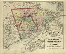
Counties of Westmoreland and Albert: New Brunswick
Description: The map shows the counties of Westmoreland and Albert in New Brunswick. Shown are bays, Cumberland basin. railroads and stations, roads, cities and towns.
Publisher: Roe Brothers
Province: New Brunswick
Type: geological maps
Date Issued (Source): 1878
Dominion of Canada: (Eastern Sheet)
Description: Map showing the province of Quebec, New Brunswick, Nova Scotia, and Prince Edward Island. Shows rivers, lakes, channels, bays, roads, railroads, cities, and towns. The provinces and cities are tinted… more
Publisher: J. H. Meacham & company
Province: Quebec, New Brunswick, Nova Scotia, Prince Edward Island
Type: pictorial maps
Date Issued (Source): 1880
Military Directory - 105th Battalion - 6
Description: A directory listing of officers and men killed in action in the Prince Edward Island's Honor Roll from Prince Edward Island more
Publisher: Cummins Map Co.
Province: Prince Edward Island
Type: text
Date Issued (Source): 1927
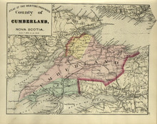
County of Cumberland: Nova Scotia
Description: The map shows the county of Cumberland in Nova Scotia. Shown are bays, channels, basins, mountains, rivers, railroads and stations, lakes, cities and towns.
Publisher: Roe Brothers
Province: Nova Scotia
Type: geological maps
Date Issued (Source): 1878
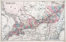
Dominion of Canada: (Western Sheet)
Description: Map showing the province of Ontario, and Quebec. Shows rivers, lakes, channels, bays, roads, railroads, cities, towns, copper mines, and sea measurements. Ontario and Quebec are coloured and cities… more
Publisher: J. H. Meacham & company
Province: Ontario, Quebec, Prince Edward Island, Michigan, New York, Ohio
Type: cadastral maps
Date Issued (Source): 1880
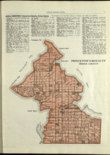
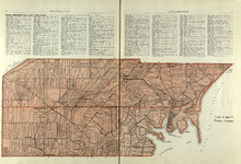
Princetown Royalty: Prince County
Description: The map shows Princetown Royalty in Prince County. Shown are rivers, bays, roads, landowners, acreage, and towns. Atlas of Province of Prince Edward Island, Canada and the World
Publisher: Cummins Map Co.
Province: Prince Edward Island
Type: cadastral maps
Date Issued (Source): 1927
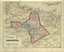
County of Colchester: Nova Scotia
Description: The map shows the county of Colchester in Nova Scotia. Shown are railroads and stations, basins, rivers, mountains, cities and towns.
Publisher: Roe Brothers
Province: Nova Scotia
Type: geological maps
Date Issued (Source): 1878
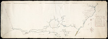
Lot No. 1 : Prince County
Description: The map shows Lot 1 in Prince county. Shown are the Gulf of St. Lawrence, ponds, rivers, creeks, landowners, acreage, roads and a railroad.
Publisher: Cummins Map Co.
Province: Prince Edward Island
Date Issued (Source): 1927
County of Hants: Nova Scotia
Description: The map shows the county of Hants in Nova Scotia. Shown are basins, lakes, gold mines, railroads, stations, and rivers.
Publisher: Roe Brothers
Province: Nova Scotia
Type: geological maps
Date Issued (Source): 1878
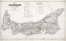
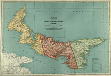
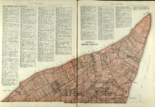
Map of the Province of Prince Edward Island: in the Gulf of St. Lawrence
Description: The map shows the province of Prince Edward Island. Shown are tables of Explanations and Electorial Districts, a compass and the county lines are marked in red. Shown are gulfs, straits, bays, reefs… more
Publisher: J. H. Meacham & company
Province: Prince Edward Island
Type: cadastral maps
Date Created: 1880
Date Issued (Source): 1880
Lots 2 & 3 : Prince County
Description: The map shows lots 2 & 3 in Prince county. Shown are the Gulf of St. Lawrence, capes, ponds, landowners, acreage, rivers, and roads.
Publisher: Cummins Map Co.
Province: Prince Edward Island
Type: cadastral maps
Date Issued (Source): 1927
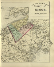
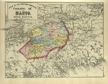
County of Kings: Nova Scotia
Description: The map shows the county of Kings in Nova Scotia. Shown are bays, brooks, creeks, lakes, railroads and stations, mines, roads, cities and towns.
Publisher: Roe Brothers
Province: Nova Scotia
Type: geological maps
Date Issued (Source): 1878
Lots 4 : Prince county
Description: The map shows Lots 4
Publisher: Cummins Map Co.
Province: Prince Edward Island
Type: cadastral maps
Date Issued (Source): 1927
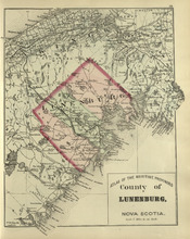
County of Lunenburg: Nova Scotia
Description: The map shows the county of Lunenburg in Nova Scotia. Shown are railroads abd stations, roads, rivers, bays, coves, basins, lakes, and harbours.
Publisher: Roe Brothers
Province: Nova Scotia
Type: geological maps
Date Issued (Source): 1878
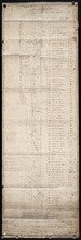
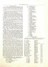
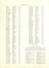
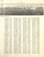
Rural Directory - Lots 4 - 6, Prince County
Description: A directory listing of residents of lots 4, 5, and 6.
Publisher: Cummins Map Co.
Province: Prince Edward Island
Type: text
Date Issued (Source): 1927