| Title Proper |
Province of Prince Edward Island, Canada
|
|---|---|
| Subtitle |
Cummins Map Co. Toronto
|
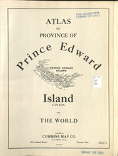
| Description |
The map shows all of Prince Edward Island and some of New Brunswick and Nova Scotia. Shown through a table of Counties are bays, roads, marshes, rapids, Indian Reserves, Lighthouses, depth of water, etc.
|
| Access Condition |
This material is provided for research, education, and private use only.
|
| Type | |
| Date Issued (Source) |
1927
|
| Publisher |
Cummins Map Co.
|
| Scale |
scale of miles
|
| Geographic - Continent | |
| Geographic - Country | |
| Geographic - Province/State | |
| Geographic - County | |
| Geographic - City | |
| Source |