Displaying 109 - 216 of 504
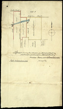
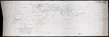
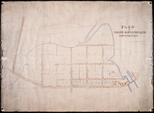
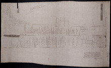
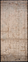
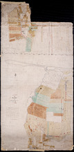
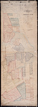
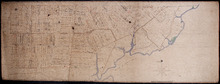
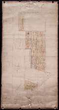
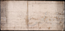
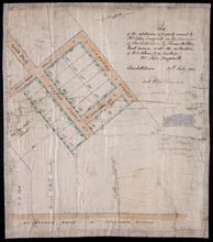
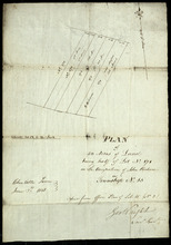
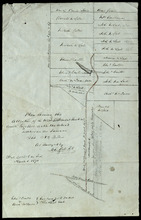
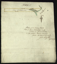
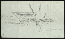
Plan shewing the situation of a Mill-pond Right on Lots 6 and 7, purchased from Samuel Sweet, by…
Description: Plan of part of Lots 6 and 7 showing the situation of a Mill-pond right purchased from Samuel Sweet by Richard Smallman and Chas. Crossman. The mill pond is located in the area where Lots 5, 6 and 7… more
Province: Prince Edward Island
Type: cadastral maps
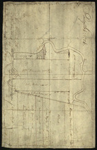
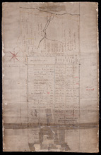
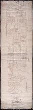
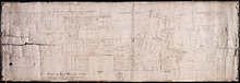
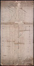
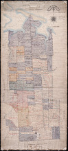
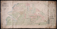
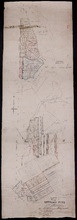
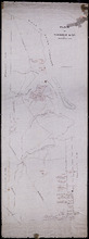
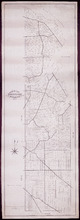
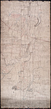
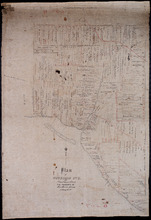
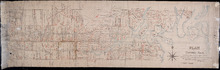
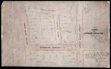
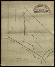
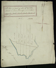
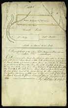
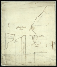
Part of Lot No. 26
Description: Plan of part of Lot 26 (No.3). Plan traced[?] by J. Plaw from a survey by Mr. Major[?]. The maps shows part of Lot 26 (the Centreville area) divided into parcels of land with the names of residents… more
Province: Prince Edward Island
Type: cadastral maps
Date Created: 1810-05-23

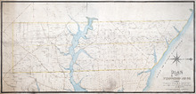
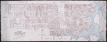
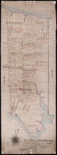
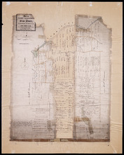
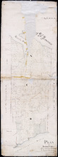
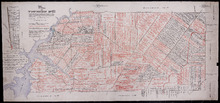
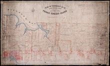
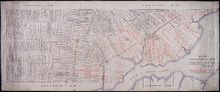
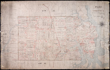
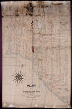
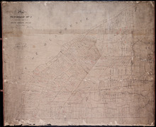
Plan of Township No. 64: compiled from the proprietors' plans, descriptions in leases and…
Description: The map shows Lot 64 divided into parcels of land with names of residents, their acreage amounts and land conveyence references. Land information written in black indicates government land;… more
Province: Prince Edward Island
Type: cadastral maps
Date Created: 1920
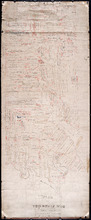
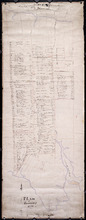
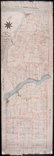
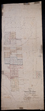
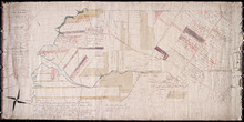
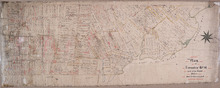
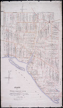
Plan of Township No. 20.: Compiled from Surveys by Jas. Stewart, L. W. Gall, George Wright, Joseph…
Description: Plan of Lot 20. The map shows Lot 20 divided into parcels of land with names of some residents and some acreage amounts. The map notes freehold land. Shows roads in a light brown colour, marsh areas… more
Province: Prince Edward Island
Type: cadastral maps

Plan of Township No. 5: compiled from plans, leases, deeds, and other documents on file in the Land…
Description: Plan of Lot 5 compiled from plans, leases, deeds, and other documents on file in the Land Office. The map shows Lot 5 divided into parcels of land with names of residents, their acreage amounts and… more
Province: Prince Edward Island
Type: cadastral maps
Date Created: 1911-09
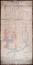
Plan of Township No. 6: Compiled from plans, leases, deeds, and other documents on file in the Land…
Description: The map shows Lot 6 divided into parcels of land with names of residents, their acreage amounts and land conveyance references handwritten in black and red ink. Shows the P.E.I. Railway in red, roads… more
Province: PE
Type: cadastral maps
Date Created: 1912-01
Plan Showing the Situation of Joseph Hammil's Farm on Lot No. 2. Containing Thirty acres on…
Description: Plan of part of Lot 2 showing Joseph Hammill's Farm containing 30 acres. The map shows Joseph Hammill's 30-acre parcel shaded in a greenish colour. It also shows the adjacent parcel of John… more
Province: PE
Type: cadastral maps
Plan of Township No. 56: Copied from the Survey of J. C. Underhay By Owen Curtis. L. S.
Description: Plan of Lot 56 (No.150). Shows names of residents, acreage, and some land conveyance references. Surveyed by J.C. Underhay and copied by Owen Curtis. The map also shows bodies of water such as… more
Province: Prince Edward Island
Type: cadastral maps
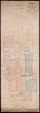
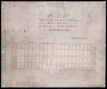
Plan of Lot 50
Description: Plan of Lot 50. Shows names of residents, acreage, and some land conveyance references, roads, and bodies of water such as rivers (Orwell), and bays (Pownal).
Province: Prince Edward Island
Type: cadastral maps

Plan of Township No. 55: Compiled from the plans on file in the Land and Registry Offices, from the…
Description: Plan of Lot 55 compiled from the plans on file in the Land and Registry Offices, from the descriptions in the registered Grants and from Meacham's Atlas. Shows names of residents, acreage, and… more
Province: Prince Edward Island
Type: cadastral maps
Date Created: 1919

Township No. Fiftyfour. St. Georges Parish. Kings County. Prince Edward Island.: Chiefly from…
Description: Plan of Lot 54 (No.145). Shows names of residents, acreage, and some land conveyance references. Copied by H.J. Cundall. Certified plan. The map also shows bodies of water such as rivers (Cardigan),… more
Province: Prince Edward Island
Type: cadastral maps
Plan of the Estate of the Hon. Spencer Cecil Brabazon Ponsonby Fane Situate on Lot or Township No.…
Description: Plan of Lot 53 showing the estate of the Hon. Spencer Cecil Brabazon Ponsonby Fane. Copied by R.T. Weeks. Shows names and acreage of some residents, roads, and rivers such as Morell.
Province: Prince Edward Island
Type: cadastral maps
Plan of Lot or Township No. 53, shewing the positions of the respective boundaries thereof. Those…
Description: Plan of Lot 53 showing the position of the boundaries of the Melville, Selkirk and Westmoreland Estates (No.5). Shows names and acreage of a few residents, bodies of water such as rivers (Brudnell),… more
Province: Prince Edward Island
Type: cadastral maps
Royalty of Georgetown
Description: Plan of Lot 53 showing the estate of Lady Westmoreland. Shows names of residents and acreage, roads, and bodies of water such as rivers (Montague). Also shows the division line between the estate of… more
Province: Prince Edward Island
Type: cadastral maps
Plan Township No. 53. comprising parts of the Melville, Selkirk, and Fane Estates. Compiled and…
Description: Plan of Lot 53 comprising parts of the Melville, Selkirk and Fane Estates (No.144). Shows names, acreage, and land conveyance references for some residents, bodies of water such as rivers, and… more
Province: Prince Edward Island
Type: cadastral maps
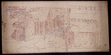
Plan of Pierce Gaul's Estate Montague-Bridge
Description: Plan of Pierce Gaul's Estate, Montague Bridge, Lot No.52. The map shows the Montague River, streets, and buildings. more
Province: Prince Edward Island
Type: cadastral maps
Date Created: 1877-05

Plan of Lot or Township No. 51 in Kings County P. E. Island
Description: Plan of Lot 51 (No.139) Colour code shows freehold and unsold portions. Sir Graham Montgomery Estate. Shows names, acreage, and land conveyance references of some residents, and roads.
Province: Prince Edward Island
Type: cadastral maps
Plan of Township No. 50, the Property of Maria Susanna Matilda Fanning
Description: Plan of Lot 50, the property of Maria Susanna Matilda Fanning. Shows names of residents, acreage, and land conveyance references, bodies of water such as rivers (Vernon), bays (Pownal), and roads.… more
Province: Prince Edward Island
Type: cadastral maps

Plan of certain tracts of land at or near Orwell according to registered deeds, and two surveys…
Description: Plan of part of Lot 50. Clark's Corner, Orwell. Shows certain tracts of land at or near Orwell according to registered deeds and two surveys. Rough copy included. more
Province: Prince Edward Island
Type: cadastral maps
Plan of Part of Township No. 49. Bedford Parish. Queens County. P. E. Island.
Description: Plan of part of Lot 49 (No.135). One of the plans referred to in the deed from Sir Edward, William, and Laura Cunard to the Commissioner of Public Lands, July 13, 1866. The portion of land intended… more
Province: Prince Edward Island
Type: cadastral maps
Date Created: 1850
Plan of part of Lot 50
Description: Plan of part of Lot 50 (No.13). Area east of the Murray Harbour Road, north of the Dundee Road, and south of Georgetown Road. Shows names of residents.
Province: Prince Edward Island
Type: cadastral maps

Plan of Township Number 49. Shewing "Cunard" portion borderd. yellow. "Loan Act…
Description: Plan of Lot 49 showing Cunard portion bordered yellow, Loan Act Land bordered green, and remainder of Township (No.134). Copied from Meacham's Atlas by Owen Curtis. Shows names of residents,… more
Province: Prince Edward Island
Type: cadastral maps
Date Created: 1883-08
Plan of Lot 48 east of Fullerton's Creek
Description: Plan of that part of Lot 48 east of Fullerton's Creek. Shows names of residents and acreage. (No.13 in Plan Book) (Also, No.924) more
Province: Prince Edward Island
Type: cadastral maps
Date Created: 1874-01
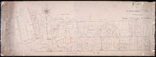
Lot 45 (No.122)
Description: Plan of the northeastern part of Lot 45 (No.122). Shows names of residents and acreage and a nautical compass.
Province: Prince Edward Island
Type: cadastral maps
Plan of Township No. 44. Corrected from Surveys by Owen Curtis, J. C. Underhay and others. By Thos…
Description: Plan of Lot 44 (No.118) corrected by Thomas MacKinlay from surveys by Owen Curtis, J.C. Underhay and others. Cunard Estate. Shows some residents' names, acreage, and land conveyance references,… more
Province: Prince Edward Island
Type: cadastral maps
Date Created: 1887-09
Plan of Township No. 44.
Description: Plan of Lot 44 (No.120). Cunard Estate. Shows names and acreage of some residents, bodies of water such as rivers and gulfs, roads, and a mills (MacGowans).
Province: Prince Edward Island
Type: cadastral maps
A Plan of Lot or Township No. 43, Comprising the Haviland, Townsend, and Worrell Estates. Compiled…
Description: Plan of Lot 43 (No.116) comprising the Haviland, Townshend, and Worrell Estates. Completed from the surveys of J. Ball and J.C. Underhay by Owen Curtis. Shows names of residents, acreage, and land… more
Province: Prince Edward Island
Type: cadastral maps
Date Created: 1876-08
Plan of Lot 42 (No.112)
Description: Plan of Lot 42 (No.112). Shows names and acreage of some residents, bodies of water, and roads.
Province: Prince Edward Island
Type: cadastral maps
Pla of Lot or Township No. 42
Description: Plan of Lot 42 (No.113). Worrell Estate. Shows names of residents, acreage, and land conveyance references.
Province: Prince Edward Island
Type: cadastral maps
A Map and Survey of Part of Township Number Thirtyfive south side of the Hillsborough river, by…
Description: A map and survey of part of Lot 35, south side of the Hillsborough River. Shows names of residents, acreage, and land conveyance references, bodies of water such as rivers, and raods.
Province: Prince Edward Island
Type: cadastral maps
Date Created: 1887-03
Plan of Lot 39
Description: Plan of Lot 39. Shows names of residents and acreage, bodies of water such as rivers, and bays, and division lines.
Province: Prince Edward Island
Type: cadastral maps
Date Created: 1857-07-01
Plan of Lot or Township No. 38: Compiled from the Survey of Jos.h Ball by O. Curtis, Land Office…
Description: Plan of Lot 38 (No.102). Shows names of residents, acreage, and some land conveyance references, bodies of water such as bays, rivers, ponds, gulfs, and harbours, roads, and a nautical compass.
Province: Prince Edward Island
Type: cadastral maps
Date Created: 1876-08

Plan of Lot Thirty Seven: Queens Co., P.E.I.
Description: Map of Lot 37 and part of Lot 38. Map is from Meacham's 1880 PEI Historical Atlas. A few land conveyance references have been added in red ink. The map shows bodies of water such as rivers,… more
Province: Prince Edward Island
Type: cadastral maps
Date Created: 1880
Plan of Fort Augustus and Monaghan Settlement in Township Number 36, in Prince Edward Island, the…
Description: Plan of Fort Augustus and Monaghan Settlement in Lot 36, the property of the Rev. John McDonald. Shows names of residents and acreage, bodies of water such as rivers (Hillsborough), ponds, roads, and… more
Province: Prince Edward Island
Type: cadastral maps
Date Created: 1840
Plan of Township No. 36 Comprising the Estates of Helen Jane MacDonald, Rev. J. A. S. MacDonald and…
Description: Plan of Lot 36 (No.100) comprising the Estates of Helen Jane MacDonald, Rev. J.A.S. MacDonald, and W.C. MacDonald. Shows names of residents, acreage, and land conveyance references, bodies of water… more
Province: Prince Edward Island
Type: cadastral maps
A Plan of part of Township No. 36
Description: A plan of the estate of the late Hon. Donald McDonald comprising part of Lots 35 and 36 divided and apportioned into six shares by Messrs. Aldous, Cundall, and Haythorne under power of an agreement… more
Province: Prince Edward Island
Type: cadastral maps
Date Created: 1865-02-03
A Plan of Township No. 34, The Property of Sir Graham Montgomery & Brothers Situate in Queens…
Description: Plan of Lot 34 (No.89). The property of Sir Graham Montgomery & Brothers. Shows names of residents and acreage, bodies of water such as rivers, and bays, roads, and a nautical compass.
Province: Prince Edward Island
Type: cadastral maps
Date Created: 1850-03-19
Plan of Township No,, 34 in Queens County in P. E. Island. The Property of Messrs,, Montgomeries,…
Description: Plan of Lot 34. Property of Messrs. Montgomery. Shows names of residents and acreage. Plan handed in to Registry Office by Aemeas McDonald. The map also shows bodies of water, bays, rivers, ponds,… more
Province: Prince Edward Island
Type: cadastral maps
Date Created: 1853-08
Plan "B" part of Township No. 33. as divided amongst the Children of the late Alfred…
Description: Plan of part of Lot 33 as divided amongst the children of the late Alfred Winsloe. Plan B. (No.87). The map also shows Rustico and Covhead Bays, along with Brackley Point, Union, Malpeque, and… more
Province: Prince Edward Island
Type: cadastral maps
Date Created: 1872-06-11
Plan of Township No. 33 In Prince Edward Island. Part of the Estate of the late John Hodges Winslow…
Description: Plan of Lot 33 (No.88). Part of the estate of the late John Hodges Winslow. Copied from the Original Plan by Thos. MacKinlay, April 23, 1847. Shows names of residents, acreage, and land conveyance… more
Province: Prince Edward Island
Type: cadastral maps
Date Created: 1847-04-23
Plan of Township No. 33. in Prince Edward Island.: referred to in the Deed of Partition [...]
Description: Plan of Lot 33 referred to in the Deed of Partition between Alfred Winsloe, Henry Winsloe, Sydney T. Evans and wife, and Anne Winsloe, March 13, 1863. Shows names of residents and acreage, bodies of… more
Province: Prince Edward Island
Type: cadastral maps
Date Created: 1863-03-13
Plan of Lot 32 (No.86).: Cunard Estate.
Description: Plan of Lot 32 (No.86). Cunard Estate. Shows names of residents, acreage, and some land conveyance references, bodies of water such as creeks and rivers, and roads. Copied by Owen Curtis.
Province: Prince Edward Island
Type: cadastral maps
Date Created: 1876-07

Plan of Township No. 32: compiled from the proprietors plans and Meacham's Atlas and from the…
Description: The map shows Lot 32 divided into parcels of land with names of residents, acreage amounts and land conveyance references. Areas drawn in black indicate government land; areas in red indicate… more
Province: Prince Edward Island
Type: cadastral maps
Date Created: 1919-01
Plan of Township No. 32 situate in the Parish of Charlotte, Queens County, P. E. Island: Scale 20…
Description: Plan of Lot 32 (No.85). One of the plans referred to in the Deed from Sir Edward, William, and Laura Cunard to the Commissioner of Public Lands, July 13, 1866. Shows names of residents, acreage, and… more
Province: Prince Edward Island
Type: cadastral maps
Date Created: 1849
Plan of Township No. 31 in Prince Edward Island
Description: Plan of Lot 31 from H.J. Cundall, one of the Trustees of the Wm. Douse Estate (Death of Wm. Douse in 1864). Shows names of residents, acreages, and some land conveyance references, bodies of water… more
Province: Prince Edward Island
Type: cadastral maps
Plan of Township No. 31: compiled from the proprietors plans and Meacham's Atlas and from the…
Description: Plan of Lot 31 compiled from the Proprietors' plans and Meacham's Atlas and from the descriptions in leases and registered deeds, with additions and corrections from various surveys made… more
Province: Prince Edward Island
Type: cadastral maps
Date Created: 1917-12
Titles to Lot 31
Description: Plan of Lot 31 (No.84). Douse Estate. Shows names of some residents, some acreage, some land conveyance references, roads, and a nautical compass.
Province: Prince Edward Island
Type: cadastral maps
Plan of the East Moriety of Lot or Township No 29: part of the Estate of Lord Vicount Melville…
Description: Plan of the east moiety of Lot 29 (No.79). Part of the estate of Lord Viscount Melville. Shows names of residents, acreage, and a few land conveyance references, bodies of water such as the… more
Province: Prince Edward Island
Type: cadastral maps
Plan of Township No. 26: Embracing the Thomson Holland and Stephens Estates
Description: Plan of Lot 26 embracing the Thomson, Holland, and Stephens Estates. Shows names of residents, acreage, and land conveyance references, bodies of water such as river, cove, and pond, roads, and a… more
Province: Prince Edward Island
Type: cadastral maps
Plan of the North Moriety of a Township No. 26 the Property if the Messrs Thompson of Belfast…
Description: Plan of the North Moiety of Lot 26, the property of the Messrs. Thompson of Belfast Ireland. Shows names of residents, acreage, and a few land conveyance references, bodies of water such as Bedeque… more
Province: Prince Edward Island
Type: cadastral maps
Date Created: 1875-11-05
Plan "A" Part of Township No. 24: as divided amongst the children of the late Alfred…
Description: Plan "A" part of Lot 24 as divided amongst the children of the late Alfred Winsloe (No.64). Shows names of residents and acreage, bodies of water such as rivers, creeks, roads, and a… more
Province: Prince Edward Island
Type: cadastral maps
Date Created: 1872-06-11
Plan of Lot 24 (No.66): Part of the estate of John Hodges Winsloe
Description: Plan of Lot 24 (No.66). Part of the estate of John Hodges Winsloe. Shows names of residents, acreage, and a few land conveyance references, bodies of water such as Gulf of St. Laurence, rivers, roads… more
Province: Prince Edward Island
Type: cadastral maps
Date Created: 1847
This is the Plan of Township No. 24 in Prince Edward Island
Description: Plan of Lot 24 showing the division of the Winsloe Estate. Shows names of residents and acreage, bodies of water such as gulfs, bays, creeks, rivers, sand hills, Rustico or Peter's Island and… more
Province: Prince Edward Island
Type: cadastral maps
Date Created: 1863-03-13
Plan of Township No. 24 in Prince Edward Island
Description: Plan of Lot 24. Smith Estate. Mainly outline but shows a few residents and acreage, bodies of water such as rivers, gulfs, bays and creeks, roads, sand hills, and Rustico or Peter's Island. more
Province: Prince Edward Island
Type: cadastral maps
Plan of the property of Mrs W.L. Smith : Situate on Township No. 24 in Prince Edward Island, Mrs L…
Description: Plan of the property of Mrs W.S. Smith. Situated on Lot 24. The maps shows bodies of water such as rivers and creeks, Rustico Island, roads, and a nautical compass.
Province: Prince Edward Island
Type: cadastral maps
Plan of Township No. 24 Situate in Grenville Parish. Queen's County. P.E.Island.: Complied…
Description: Plan of Lot 21 situate in Grenville Parish (No.54). Compiled from actual surveys. Cunard Estate. Shows names of residents and acreage, bodies of water such as gulfs, rivers, and creeks, roads, and a… more
Province: Prince Edward Island
Type: cadastral maps
Date Created: 1844
Plan of Lot Twenty One : Queens Co P.E.I.
Description: Plan of Lot 21 drawn from old maps, plans, and records. Shows names of residents, acreage, and land conveyance references, bodies of water such as bays, ponds, gulfs, and rivers, roads, and a… more
Province: Prince Edward Island
Type: cadastral maps
Date Created: 1952
Plan of part of Lot 19 (No.48)
Description: Plan of part of Lot 19 (No.48). Hodgson and Yeo Estates. Shows names of some residents, bodies of water such as bays, roads, division lines.
Province: Prince Edward Island
Type: cadastral maps
Plan of Township No. 16 in Prince Edward Island: The Property Of Miss Sullivan
Description: Plan of Lot 16 (No.44). The property of Miss Sullivan. Shows names of residents, bodies of water, roads, and a compass. Color code shows freehold lands purchased from the Proprietor and other… more
Province: Prince Edward Island
Type: cadastral maps
Plan of Township No. 19: Situate in Prince County The Property of A.T.Todd ESQ. Toronto, Prince…
Description: Plan of Lot 19, the property of A.T. Todd, Toronto. Plan referred to in the Indenture dated 11 November, 1871 between A.T. Todd and E.J. Hodgson. Plan also referred to in a conveyance from E.J.… more
Province: Prince Edward Island
Type: cadastral maps
Plan of Lot 14
Description: Plan of Lot 14 (No.40). Cunard Estate. Shows names of some residents, acreage, and a few land conveyance references. The map shows bodies of water such as Ellis (or Grand) River, and Cross River,… more
Province: Prince Edward Island
Type: cadastral maps
Date Created: 1847
Plan of Township No 14: Compiled from the proprietors' plans and Meacham's Atlas, and…
Description: Plan of Lot 14 compiled from the proprietors' plans and Meacham's Atlas, and from the descriptions in leases and deeds, with additions and corrections from the reports of various surveys on… more
Province: Prince Edward Island
Type: cadastral maps
Date Created: 1914

Plan of Lot or Township No 14 : Situate in the Parish of Richmond, Prince County P.E.Island
Description: Plan of Lot 14 situate in the Parish of Richmond. One of the plans referred to in the deed from Sir Edward, William, and Laura Cunard to the Commissioner of Public Lands, July 13, 1866. Shows names… more
Province: Prince Edward Island
Type: cadastral maps
Plan of Township No 14: part of the Cunard Estate.
Description: Plan of Lot 14 (No.39). Part of Cunard Estate. Shows names of residents, acreage, and some land conveyance references. The map shows bodies of water, roads, post offices, a railroad station, and a… more
Province: Prince Edward Island
Type: cadastral maps

Plan of Lot or Township of No. 13 in Prince County: Prince Edward Island
Description: Plan of Lot 13 (No.35). Yeo Estate. Shows names of residents, acreage, and some land conveyance references. Color code (orange, and yellow) shows willed land and freehold land. The map also shows… more
Province: Prince Edward Island
Type: cadastral maps
Date Created: 1875-10-09
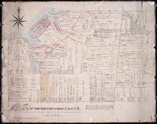
Plan of the Western End of Lot 13.: Corrected from recent Surveys, also shewing Leases, Ledger…
Description: Plan of the western end of Lot 13 (No.37). Yeo Estate. The map shows the western part of Lot 13 divided into parcels of land with names of residents, their acreage amounts and land conveyance… more
Province: Prince Edward Island
Type: cadastral maps
Plan of Township No. 12: Copied from Survey by John Ball L.S. by Thos Mackinlay
Description: Plan of Lot 12 (No.34). Stewart Estate. Copied from survey of John Ball by Thos. MacKinlay. Shows names of residents, acreage, and land conveyance references. The map shows bodies of water, Lennox (… more
Province: Prince Edward Island
Type: cadastral maps
Plan of Township No. 12
Description: Plan of Lot 12 (No.33). Stewart Estate. Shows names of residents and some acreage and land conveyance references. The map shows bodies of water, roads, a railroad station, and Lennox Island.
Province: Prince Edward Island
Type: cadastral maps
Plan of Part of Lot or Township Number Eleven: by A. Anderson, 1847
Description: Plan of part of Lot 11 (No.31). Stewart Estate. Shows names and acreage of some residents, bodies of water such as rivers, roads, and a compass.
Province: Prince Edward Island
Type: cadastral maps
Date Created: 1847
Plan of Township No. 11: compiled from the plans by the late Alexander Anderson L. S on file in the…
Description: The map shows Lot 11 divided into parcels of land with names of residents, their acreage amounts and land conveyance references. Shows the P.E.I. Railway in red, roads in light brown. Bodies of water… more
Province: Prince Edward Island
Type: cadastral maps
Date Created: 1910
Plan of Township Number 10. Surveyed by John Ball, L. S.
Description: Plan of Lot 10 (No.28). Stewart Estate. Shows names of residents, acreage, and a few land conveyance references, bodies of water such as rivers, lakes, bays, and creeks, roads, and Bird Island.
Province: Prince Edward Island
Type: cadastral maps
Plan of Township No. 9: Copied from plan furnished by Proprietress with alterations and additions…
Description: Plan of Lot 9 (No.26). Sullivan Estate. Copied from plan furnished by Proprietress with alterations and additions from surveys by Owen Curtis, John Clay &c. Shows names of residents, acreage, and… more
Province: Prince Edward Island
Type: cadastral maps
Date Created: 1883-08-18
Plan of Township No. 9: compiled from the proprietors' plans and the descriptions in the…
Description: Plan of Lot 9 compiled from the proprietors plans and the descriptions in the leases and deeds, with additions and corrections from the various surveys. The map shows Lot 9 divided into parcels of… more
Province: Prince Edward Island
Type: cadastral maps
Date Created: 1909
Lot 9
Description: Plan of Lot 9 (No.25). Sullivan Estate. Shows names of residents, acreage, and land conveyance references, rivers, roads, and Sandy or Brae Islands.
Province: Prince Edward Island
Type: cadastral maps
Plan of Township No. 9 in Prince Edward Island: The Property of Miss Charlotte Sullivan containing…
Description: Plan of Lot 9 (No.27). The property of Miss Charlotte Sulivan, containing 17300 acres. Shows names of residents and acreage, bodies of water such as rivers, creeks, roads, Sandy or Brae Island, and… more
Province: Prince Edward Island
Type: cadastral maps
Lot 8
Description: Plan of the eastern part of Lot 8 (No.24). Ramsay Estate. Shows names of some residents, acreage, and some land conveyance references, rivers, roads, and sand hills.
Province: Prince Edward Island
Type: cadastral maps
Plan of Township No. 7, Prince County, Prince Edward Island, From Actual Survey by John Clay L. S…
Description: Plan of Lot 7 (No.21). Stewart Estate. Shows names of residents and acreage, bodies of water such as the Gulf of St. Lawrence, ponds, and roads.
Province: Prince Edward Island
Type: cadastral maps
Date Created: 1877-04-09

Plan of Township No. 6: Compiled from plans, leases, deeds, and other documents on file in the Land…
Description: The map shows Lot 6 divided into parcels of land with names of residents, their acreage amounts and land conveyance references handwritten in black and red ink. Shows the P.E.I. Railway in red, roads… more
Province: Prince Edward Island
Type: cadastral maps
Date Created: 1912-01
Plan of Township No. 5: compiled from plans, leases, deeds, and other documents on file in the Land…
Description: Plan of Lot 5 compiled from plans, leases, deeds, and other documents on file in the Land Office. The map shows Lot 5 divided into parcels of land with names of residents, their acreage amounts and… more
Province: Prince Edward Island
Type: cadastral maps
Date Created: 1911-09
Plan of Lot or Township No. 5 in Prince Edward Island: The Shore and the Division line, coloured…
Description: Plan of Lot 5. The Shore and the Division line, coloured Yellow are according to actual Survey by A. Anderson. Shows names of residents, acreage, and land conveyance references, bodies of water such… more
Province: Prince Edward Island
Type: cadastral maps
Date Created: 1840
Plan of Township No. 5: Copied from Plans in Land Office, with many addition and corrections from…
Description: Plan of Lot 5 (No.17). Cunard Estate. Copied from plans in Land Office with many additions and corrections from more recent surveys. Also sundry data connecting the lands with their ledger folios,… more
Province: Prince Edward Island
Type: cadastral maps
Date Created: 1886
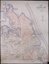
Plan Shewing the division of Pasture Lots Nos. 61, 62, 70 & 71 in the Royalty of Charlotte Town
Description: Plan showing the division of Pasture or Royalty Lots No.61, No.62, No.70 and No.71 in the Royalty of Charlottetown.
Province: Prince Edward Island
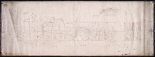
Plan of building lots on the west side of Hillsborough Street, Charlottetown
Description: Plan of building lots on the west side of Hillsborough Street between Grafton and Richmond Streets, Charlottetown. Town Lots No.58, No.59, No.60 and No.95, No.96, No.97 in the 2nd Hund.
Province: Prince Edward Island
Type: cartograms map
Plan of the subdivision of property owned by Mrs. John Longworth in the Commons of Charlottetown:…
Description: Plan of the subdivision of property owned by Mrs. John Longworth in the Commons of Charlottetown, Common Lot No.29. Plan made under the instructions of H.J. Palmer, Trustee for Mrs. John Longworth. (… more
Province: Prince Edward Island
Type: cadastral maps
Date Created: 1923-07-19
Part of Common Lot No. 22.
Description: Plan of part of Common Lot No.22, Charlottetown.
Province: Prince Edward Island
Type: cadastral maps
Date Created: 1886
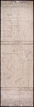
Reserved or Settlement road on Lot 5
Description: Plan of part of Lot 5. The farms on the north side of the Reserved or Settlement Road. The map shows 20 parcels of land on the north side of the Reserve or Settlement Road in the western portion of… more
Province: Prince Edward Island
Type: cadastral maps
Plan Shewing the Situation of Plot No. 94 on Lot or Township No. 15
Description: Plan of part of Lot 15 (No.74). Shows the situation of Plot No.94, the property of John MacInally. 77 acres. MacInally's plot is shaded green. Map also shows Joseph Gallant's Plot No. 93 to… more
Province: Prince Edward Island
Type: cadastral maps
Plan of 50 Acres of Land being half of Lot No. 171 in the Occupation of John Rechore in Township No…
Description: Plan of part of Lot 15. 50 acres of land, part of 171 in the occupation of John Rechore. Also shows (sub) lots 170, 172, 173 and 174. Copied from office plan of Lot 15. (No.3)
Province: Prince Edward Island
Type: cadastral maps
Date Created: 1851-06-03
Plan of 500 Acres Land in Egmont Bay 7th February 1814
Description: The map shows 500 acres of land around the mouth of the Haldimand River in Egmont Bay, northeast of Cape Egmont. Plan of part of Lot 15 (No.4).
Province: Prince Edward Island
Date Created: 1814-02-07
Half Lot No. 18
Description: Plan of the eastern half of Lot 18 (No.3). Mainly outline.
Province: Prince Edward Island
Part of Lot 18
Description: Plan of part of Lot 18 (No.6). Two Ramsay properties, each 100 acres in size, along Oyster Cove in Lot 18. Sandy and/or marshy areas shown with stippling/shading. North arrow.
Province: Prince Edward Island
Type: cadastral maps
Plan Shewing the Alteration of the West Settlement Road "as colored" together with the…
Description: Plan showing the alteration of the West Settlement Road together with the actual settlers on the same. Lot 22. The maps shows an alteration to a portion of the West Settlement Road in Lot 22. The… more
Province: Prince Edward Island
Type: cadastral maps
Date Created: 1870-03-01
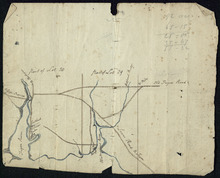
Plan of Proposed Road on A. Dickerson's Farm Township No. 23: Surveyed by John P. Nicholson P…
Description: Plan of proposed road on A. Dickerson's Farm on Lot 23. (No.53). The plan shows a proposed new road, coloured orange, through Arthur Dickerson's farm between Rennie Road and St. Mary's… more
Province: Prince Edward Island
Type: engineering maps
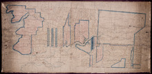
Part of Lot 25
Description: Plan of part of Lot 25 (No.4). Thompson-Taylor land. This item consists of 2 maps——on separate pieces of paper——of the parcels of land belonging to John Thompson (200 acres) and William Taylor (320… more
Province: Prince Edward Island
Type: cadastral maps
Date Created: 1809-11-20
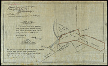
Plan of 75 Acres of land leased to John Clay, showing the different divisions in which it was…
Description: Plan of part of Lot 26. The plan shows 75 acres of land in the western part of Lot 26 leased to John Clay and then later divided and conveyed to other individuals. The plan shows names of residents… more
Province: Prince Edward Island
Type: cadastral maps
Date Created: 1878-08-05
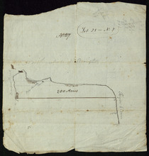
Lot 28 -- No. 2
Description: Plan of part of Lot 28 (No.2). The map shows 200 acres of land along the Northumberland Strait between Crapuad Creek and the Tryon River in Lot 28. Areas that appear to be marshes are indicated with… more
Province: Prince Edward Island
A Plan of part of Lot No. XXVIII. Situate in Prince County P. E. Island
Description: Plan of part of Lot 28 (No.3). The map shows 6 parcels of land with residents' names at Cape Traverse in Lot 28. The Northumberland Strait (which is labelled as the Gulf of St. Lawrence) is… more
Province: Prince Edward Island
Type: cadastral maps
Part of Lots 28 and 29
Description: Plan of part of Lots 28 and 29 (No.9). The maps shows the area around the Tryon and Westmoreland (or Crapaud) rivers in Lots 28 and 29. It gives the names of a few residents and shows several roads,… more
Province: Prince Edward Island
Plan of 117 ½ Acres of Land in the possession of James C. Wright together with several adjoining…
Description: Plan of part of Lot 29. 117½ acres of land in the possession of James C. Wright together with several adjoining tracts. Traced from original unsigned plan of Mr Clay by Thos. MacKinlay, June 17, 1882… more
Province: Prince Edward Island
Type: cadastral maps
Date Created: 1879-11-28
Plan of 100 Acres of Land Part of Lot or Township No. 32.: Situate in Queens County In the Island…
Description: Plan of part of Lot 32 (No.5). 100 acres of land, the property of Alexr. McKenzie. The plan shows 100 acres of land belonging to Alexander McKenzie, outlined in yellow, on the west side of the York (… more
Province: Prince Edward Island
Type: cadastral maps
Part of Lot 32: The property of Robert Hodgson
Description: Plan of part of Lot 32 (No.6). The map shows 200 acres of land, outlined in yellow, belonging to Robert Hodgson on the west side of the Prince Town Road in Lot 32. It shows some neighbouring parcels… more
Province: Prince Edward Island
Type: cadastral maps
Date Created: 1810
Refugee Lots on Lot 32 Prince Edward Island: Copied from the Original Plan
Description: Plan of Refugee Lots on Lot 32. Copied from the original. The map shows a northern portion of Lot 32 divided into numbered refugee lots, each 100 acres in size. It gives the names of some residents,… more
Province: Prince Edward Island
Type: cadastral maps
Date Created: 1809
Part of Lot 32: Refugee Lots
Description: Plan of part of Lot 32 (No.4). Refugee Lots. The map shows a northern part of Lot 32 that was divided into refugee lots. It gives the names of residents and acreage amounts for some. The map shows a… more
Province: Prince Edward Island
Type: cadastral maps
Part of Lot 32
Description: Plan of part of Lot 32. North Milton area. The map shows the area around the intersection of the New Glasgow and Rustico roads in the northern part of Lot 32. The land is divided into parcels with… more
Province: Prince Edward Island
Type: cadastral maps
Part of Lot 33: Area around Rustico Bay
Description: Plan of part of Lot 33. Area around Rustico Bay. The map shows the area around Rustico Bay in the northwest part of Lot 33. It shows the land divided into parcels with names of some residents and… more
Province: Prince Edward Island
Type: cadastral maps
Parts of Lot 33: Two maps showing the northern extremities of the east and west boundaries of Lot 33
Description: Plans of two parts of Lot 33 (No.4): McMillan's Point; Grand Pere Point. This item consists of 2 maps on one sheet--one each on the front and back. Side One shows McMillan Point on Covehead Bay… more
Province: Prince Edward Island
Type: boundary maps
Part of Lot 34
Description: Plan of part of Lot 34 (No.5). Shows properties of John Millar, L. Brown, Neil Shaw, Murdock McCloud, and John Crabtree. The map shows the northwestern portion of Lot 34 divided into parcels of land… more
Province: Prince Edward Island
Type: cadastral maps