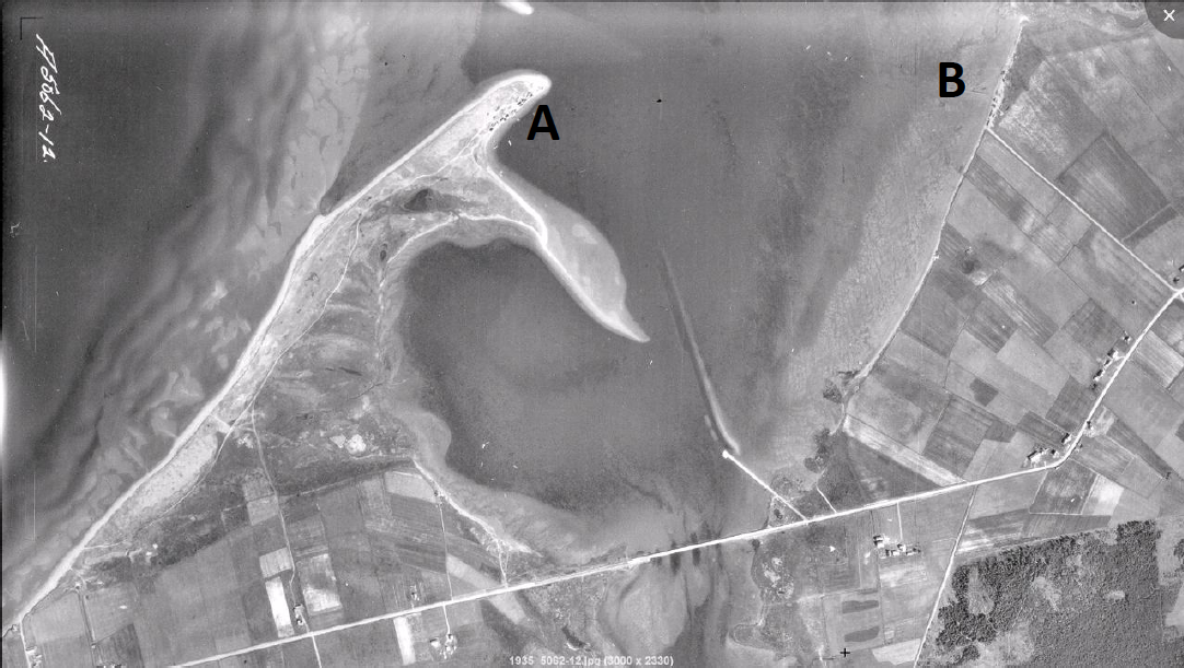
When the 1935/1936 air photographs are consulted for the same point we see that the 1927 atlas (a close copy of Meacham’s) was not entirely accurate (Figure 7).** The air photo shows a more prominent land mass in mouth of the river (A), and a concentration of vehicles or small buildings on the point. The Cummins map was correct in that the point was probably no longer a shipyard, but clearly the space was being used for some activity, most likely the fishing industry. Furtherer research in land records and business directories would help explain the fate of the shipyard, and early landscape photographs might be a source for understanding land use in this community. The air photo also shows that a large section of the properties on this point were undesirable locations for any kind of agriculture or dwellings in the 1930s.
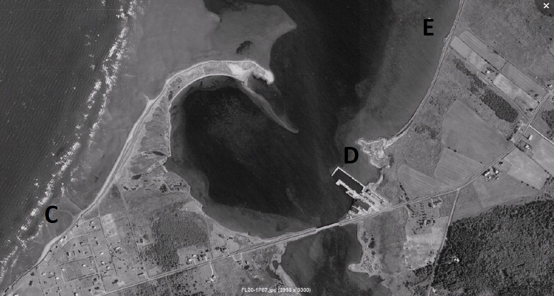
Tracing the story of the Haldimand peninsula even further to the year 2000 shows that the landscape changed dramatically over the twentieth century due to coastal erosion, currents, and changing water courses. The landscape in Figure 8 consisted of a much smaller spit, with no signs of industry on the point. Land use activity increased along the wharf area (D), and farmland was returned to forest in other areas. The lack of human response to what appears to be a steadily retreating coast line is evidenced in the increased development along the shore and the remarkably short distance between some of the new residences and the Northumberland Strait (C). Several structures which had been built along the shore before 1935 (B) were missing entirely in 2000 (E).
Comparing historical interpretations of the landscape with contemporary photography helps to put flesh on the skeletal structure that is our knowledge of human relationships with the land. This is simply another example of the importance of integrating multiple perspectives in historical research. However, there is a wealth of data in these historical maps even without the information added by the air photos. There is a gender story inherent in many historical maps, but notably even the two Meacham’s examples used here (Figure 2 and Figure 5). Women are often recorded as occupiers of land in historical atlases. For example, in Clyde River, Sarah Fisher owned five acres and at least two buildings next to the river on what is now the MacPhee Meats business. Without mill power or any farm land to speak of, it is possible that she ran a tavern, boarding house or some other business that would benefit from this high traffic rural area. By comparing Meacham’s with other cadastral maps of Lot Thirty One and sources such as business directories, it might be possible to identify Fisher and her business at other points in time.
In Lot Fifteen, one of the very few 150 acre lots was divided between Mrs. Maxim Arsenault and her daughters, although the 100 acre lot designated to the daughters had no residence. This was a common method of bequeathing property, and not surprisingly, by 1927 the large farm was sold and subdivided again. More generally, the apparent differences in the average size of properties in Lot Fifteen and Lot Thirty One, reflected not only inheritance patterns but also the economic and cultural circumstances experienced by Acadians in PEI and other minority groups throughout Canada (Clark; Bouchard). These industrial, environmental, gender, and cultural issues are just some of the many questions that can be asked of maps in conjunction with a variety of other historical materials.
** Prince Edward Island, Aerial Photographs website, http://www.gov.pe.ca/aerialsurvey/index.php3 accessed 4 May, 2010.