Displaying 1 - 6 of 6
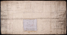
Plan of Part of Township No. 49. Bedford Parish. Queens County. P. E. Island.
Description: Plan of part of Lot 49 (No.135). One of the plans referred to in the deed from Sir Edward, William, and Laura Cunard to the Commissioner of Public Lands, July 13, 1866. The portion of land intended… more
Province: Prince Edward Island
Type: cadastral maps
Date Created: 1850
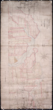
A Plan of Township No. 34, The Property of Sir Graham Montgomery & Brothers Situate in Queens…
Description: Plan of Lot 34 (No.89). The property of Sir Graham Montgomery & Brothers. Shows names of residents and acreage, bodies of water such as rivers, and bays, roads, and a nautical compass.
Province: Prince Edward Island
Type: cadastral maps
Date Created: 1850-03-19
Plan of the Western Moiety of Township No.20: Grenville Parish, Queens County, P. E. Island
Description: Plan of the Western Moiety of Township No.20, showing residents.
Province: Prince Edward Island
Type: cadastral maps
Date Created: 1850

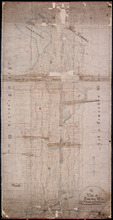
Plan of Township No. 64: St. Andrews Parish, Queens County, P. E. Island
Description: Lot 64 is situated in Kings County, not Queens County as stated in the map title. The map shows Lot 64 divided into parcels of land with names of residents and their acreage amounts. Several parcels… more
Province: Prince Edward Island
Type: cadastral maps
Date Created: 1850
Plan of the Division Line between Queens and Prince Counties & the Southern Boundary of…
Description: Plan of the division line between Queens and Prince Counties and the southern boundary of Lot 25 established by the Commissioners under the Boundary Line Act. Certified copy by G. Wright of 1835 plan… more
Province: Prince Edward Island
Type: boundary maps
Date Created: 1850
Plan of part of Township No. 21 Grenville Parish, Queens County P.E.Island: H.J. Cundall delt 1850
Description: Plan of the northern part of Lot 21 (No.56). Cunard Estate. One of the plans referred to in the deed from Sir Edward, William, and Laura Cunard to the Commissioner of Public Land, July 13, 1866.… more
Province: Prince Edward Island
Type: cadastral maps
Date Created: 1850