Displaying 1 - 4 of 4
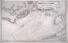
Hillsborough Bay
Description: Paper map in frame. Nautical chart originally published in 1842 and corrected and reissued many times. Large corrections in 1860, 1868, 1869, 1881. Relief is described pictorially, with hachures,… more
Publisher: Office of the Admiralty
Province: Prince Edward Island
Type: nautical charts
Date Issued: 1929
Date Created: 1842

Plan of Lot or Township No 59 Two Thirds being the property of Sir James Montgomery Brothers being…
Description: Plan of Lot 59. Two thirds being the property of Sir James Montgomery & Brothers, and one third the property of Earl Selkirk. The map shows bodies of water such as rivers, residents, lots, and… more
Province: Prince Edward Island
Type: cadastral maps
Date Created: 1842-03-01

Plan of Township No 63, St. Andrews Parish Kings County: Prince Edward Island
Description: Plan of Lot 63. Eastern part shows names of residents, lots, acreage, bodies of water such as rivers, and bays, and roads.
Province: Prince Edward Island
Type: cadastral maps
Date Created: 1842

A Trace of West Coast, Prince Edward Island: from the Survey by Capt. Bayfield, R.N. furnished at…
Description: Plan of the West Coast of Prince Edward Island from the survey by Capt. Bayfield furnished at the request of a Committee of the House of Assembly, March 18, 1842. The coast line marked in red has… more
Province: Prince Edward Island
Type: cadastral maps
Date Created: 1842