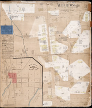
| Title Proper |
Tignish P.E.I.
|
|---|---|
| Subtitle |
Population: 500. Hook & Ladder. Nov 1897.
|
| Description |
This is a fire insurance plan of the village of Tignish. It was created in 1897 and revised to 1910. (An older plan is shown on the map Tignish_1893.) The map shows the area near Chapel Road and the railway line. A key plan in the upper right corner provides context. The map shows the town divided into numbered blocks. It shows buildings, the street numbers of the buildings and their heights in storeys. Buildings are colour-coded according to construction materials and/or use. A key on the right side explains the colour coding and symbols, which are used to depict architectural features. Labels on some buildings indicate their use. Street names and the names of some residents have been added in pencil. The map shows a portion of the P.E.I. Railway. The map shows street widths measured in feet. It states the community has a hook and ladder to fight fires. The map and the key plan have compasses with north arrows.
|
| Access Condition |
This material is provided for research, education, and private use only. For all other uses, please contact the Public Archives and Records Office of Prince Edward Island. All responsibilities for copyright are the responsibility of the user.
|
| Type | |
| Physical Location |
Public Archives and Records Office of P.E.I.
|
| Public Archives Number |
4458_s6
|
| Contributors |
Creator: Chas. E. Goad
|
| Date Created |
November 1897
|
| Date Modified |
October 1910
|
| Date Issued (Source) |
1888
|
| Publisher |
Chas. E. Goad, Civil Engineer
|
| Extent |
1 map: col.; 53 x 63 cm.
|
| Physical Description |
Paper map on cloth backing. The map has paper sections glued onto the original for the purpose of adding revisions. The map is a page bound into the book of Prince Edward Island fire insurance maps issued by Chas. E. Goad.
|
| Scale |
[appears to be] Map: 50 feet/inch. Key plan: 500 feet/inch.
|
| Geographic - Continent | |
| Geographic - Country | |
| Geographic - Province/State | |
| Geographic - County | |
| Geographic - Lot/Region | |
| Geographic - City | |
| Subject (Topical) | |
| Source |
Prince Edward Island
Creator: Chas. E. Goad, Civil Engineer
Publisher
Chas. E. Goad, Civil Engineer
Date Issued
1888
Public Archives Number
4458
|