Displaying 1 - 6 of 6

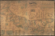
Illustrated historical atlas of the province of Prince Edward Island: From surveys made under the…
Description: Published in 1880 by the J. H. Meacham Company, the Illustrated Historical Atlas of the Province of Prince Edward Island contains maps of each Lot on the Island, maps of Charlottetown and various… more
Publisher: J. H. Meacham & company
Type: historical atlases, pictorial maps
Date Issued: 1880
Partie Orientale de la Nouvelle France ou du Canada Avec L'Isle de Terre-Neuve et de Nouvelle…
Description: Map, image: elaborate decorations of ships and such figures as Neptune, Mercury and an allegorical figure representing the spirit of cartography who holds scales and a compass. Other embellishments… more
Type: pictorial maps, topographic maps
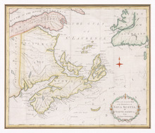
A New and Accurate Map of the Province of Nova Scotia, in North America, From the Latest…
Description: Framed map of the province of Nova Scotia and vicinity. The map shows bodies of water such as the Gulf of St. Lawrence and Bay of Fundy, towns, cities, villages, islands, banks, and a compass rose.
Province: Nova Scotia
Type: topographic maps, pictorial maps
Date Created: 1773
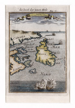
Die Insel der Neuen Erde : Isle de Terre New
Description: Two maps of Acadia in the 18th century in one frame; .1 coloured, .1 uncoloured. The map shows Canada, Acadie, and Terre Neuve, islands, water, and paintings of ships.
Type: pictorial maps
Date Created: 1690
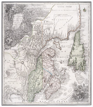
Topographical Map of Prince Edward Island in the Gulf of St. Lawrence
Description: Prince Edward Island divided into Counties and Parishes with the Lots as granted by Government, exhibiting all the New Settlements, Roads, Mills, etc. Published by H. Ashby, King Street, Cheapside,… more
Publisher: W. E. & H. H. Baker
Province: Prince Edward Island
Type: topographic maps, cadastral maps, pictorial maps
Date Created: 1863
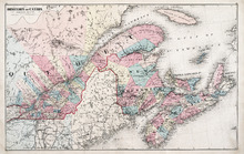
Dominion of Canada: (Eastern Sheet)
Description: Map showing the province of Quebec, New Brunswick, Nova Scotia, and Prince Edward Island. Shows rivers, lakes, channels, bays, roads, railroads, cities, and towns. The provinces and cities are tinted… more
Publisher: J. H. Meacham & company
Province: Quebec, New Brunswick, Nova Scotia, Prince Edward Island
Type: pictorial maps
Date Issued (Source): 1880