Displaying 1 - 2 of 2
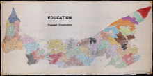
Education: Proposed Consolidation
Description: Map of Prince Edward Island. Education - proposed consolidation. Colored overlay on printed map. The map also shows the Gulf of St. Lawrence, Northumberland Strait, and various bodies of water.
Province: PE
Type: cadastral maps, thematic maps
Date Created: 1967-07

Map of Prince Edward Island
Description: Map of Prince Edward Island showing school districts(?). The map shows bodies of water and town and cities.
Province: Prince Edward Island
Type: cadastral maps, thematic maps
Date Created: 1971-02-05