Displaying 1 - 3 of 3
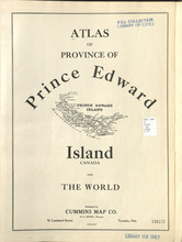
Atlas of Province of Prince Edward Island, Canada and the World
Description: Cummins devotes most of its opening pages to a detailing of the Island’s contribution to the First World War or “European War”. This event had forever changed many communities on the Island.
More… more
Publisher: Cummins Map Co.
Type: historical atlases
Date Issued: 1927

Illustrated historical atlas of the province of Prince Edward Island: From surveys made under the…
Description: Published in 1880 by the J. H. Meacham Company, the Illustrated Historical Atlas of the Province of Prince Edward Island contains maps of each Lot on the Island, maps of Charlottetown and various… more
Publisher: J. H. Meacham & company
Type: historical atlases, pictorial maps
Date Issued: 1880

Atlas of the Maritime Provinces of the Dominion of Canada with historical and geological…
Publisher: Roe Brothers
Type: historical atlases
Date Issued: 1878