Displaying 28 - 29 of 29
Die Insel der Neuen Erde : Isle de Terre Newe
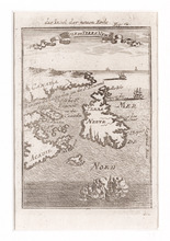
Description: Two maps of Acadia in the 18th century in one frame; .1 coloured, .1 uncoloured.The map shows Canada, Acadie, and Terre Neuve, islands, water, and paintings of ships.
Province: Newfoundland, Nova Scotia, New Brunswick, Prince Edward Island
Type: topographic maps
Date Created: 1690

Carta Geographica Del Canada Nell' America Settentrionale
Description: Framed map of Canada; cartouche top left corner: natives by a pond with deer and animals which are part dog, part fish. The map shows bodies of water such as Baja D' Hudson, villages, towns, and… more
Type: chorographic maps
Date Created: 1700 to 1799