Displaying 1 - 5 of 5
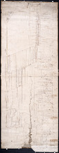
Plan of Lot 54. Incomplete.
Description: Plan of Lot 54. Incomplete. Shows names of some residents, lots, acreage, roads, and bodies of water such as creeks.
Province: Prince Edward Island
Type: cadastral maps
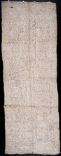
Plan of Lot 54
Description: Plan of Lot 54. Shows names of residents, lots, roads, and bodies of water such as rivers.
Province: Prince Edward Island
Type: cadastral maps

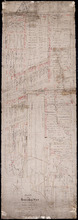
Township No. Fiftyfour. St. Georges Parish. Kings County. Prince Edward Island.: Chiefly from…
Description: Plan of Lot 54 (No.145). Shows names of residents, acreage, and some land conveyance references. Copied by H.J. Cundall. Certified plan. The map also shows bodies of water such as rivers (Cardigan),… more
Province: Prince Edward Island
Type: cadastral maps
Plan of Township No. 54: Chiefly from Surveys by Geo. Wright and Rodk. Campbell copied By Owen…
Description: Plan of Lot 54, chiefly from surveys by Geo. Wright and Rod'k Campbell. Copied by Owen Curtis, 1877. Shows names of residents, acreage, and land conveyance references, roads, bodies of water,… more
Province: Prince Edward Island
Type: cadastral maps
Date Created: 1877
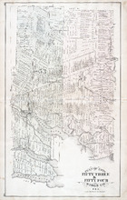
Plan of Lots Fifty Three & Fifty Four: Kings Co., P.E.I.
Description: The map shows lots 53 & 54 in Kings county. Shown are roads, railroads and stations, landowners and acreage, rivers, creeks, wharfs, post offices, and mills. Graphic compass.
Publisher: J. H. Meacham & company
Province: Prince Edward Island
Type: cadastral maps
Date Issued (Source): 1880