Displaying 1 - 1 of 1
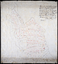
Copy of a plan made by Alexander Anderson in 1845 of that portion of the northern part of Lot 11…
Description: Copy of a plan made by Alexander Anderson in 1845 of that portion of the northern part of Lot 11 sold at various times for land taxes. Plan shows property bought by David Ramsay at a Sheriff's… more
Province: Prince Edward Island
Type: cadastral maps
Date Created: 1909