Displaying 1 - 5 of 5
A Plan of Lot 18: situated in Prince County in the Island of St. John enlarged and Drawn from the…
Description: Sketch plan of Lot 18 (Plan No.46) showing property of Peter Stewart, Robert Stewart, and Wm. Allanby. Surveyed by Thomas Wright. Office copy by Jos. Ball and certified by Geo. Wright. Original was… more
Province: Prince Edward Island
Type: cadastral maps
Date Created: 1847-04-06


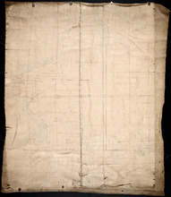
Half Lot No. 18
Description: Plan of the eastern half of Lot 18 (No.3). Mainly outline.
Province: Prince Edward Island
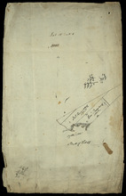
Part of Lot 18
Description: Plan of part of Lot 18 (No.6). Two Ramsay properties, each 100 acres in size, along Oyster Cove in Lot 18. Sandy and/or marshy areas shown with stippling/shading. North arrow.
Province: Prince Edward Island
Type: cadastral maps
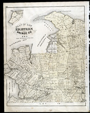
Plan of Lot Eighteen: Prince Co., P.E.I.
Description: The map shows lot 18 in Prince county. Shown are bays, capes, points, coves, post offices, schools, creeks, mills, churches, landowners and acreage, and roads. Compass.
Publisher: J. H. Meacham & company
Province: Prince Edward Island
Type: cadastral maps
Date Issued (Source): 1880