Displaying 1 - 7 of 7

Geological Map of Canada and Newfoundland: Derive from the Results of The Canadian Geological…
Description: Framed map of Canada and Newfoundland. The map is has colours for different land marks, and a table that explains it all. Shown are bodies of water such as rivers, islands, roads, towns, and cities.
Province: Newfoundland, New Brunswick, Prince Edward Island, Nova Scotia, Quebec
Type: geological maps
Date Created: 1866 (year uncertain)
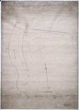
A Plan of Souris Beach
Description: Plan of part of Lots 44 and 45, Souris Beach. The map shows dry spots at low water, lots, and residents.
Province: Prince Edward Island
Type: cadastral maps
Date Created: 1866
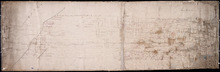
Plan of Lot 2
Description: Plan of Lot 2. Plan referred to in the deed from Sir Edward, William and Laura Cunard to the Commissioner of Public Lands. Shows names of some residents, also gives some land conveyance references,… more
Province: Prince Edward Island
Type: cadastral maps
Date Created: 1866
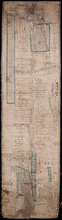
Plan of Lot 44
Description: Plan of Lot 44. Old plan referred to in deed from Sir Ed. Cunard and others to the Commissioner for Public Lands, dated 13 July, 1866.
Province: Prince Edward Island
Type: cadastral maps
Date Created: 1866
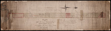
Plan of 1390 Acres of Land part of Township No. 65: The property of the Hon,, Smauel Cunard…
Description: Plan of part of Lot 65 (No.172). 1390 acres of land, part of the property of the Hon. Samuel Cunard. One of the plans referred to in the Deed from Sir Edward, William, and Laura Cunard to the… more
Province: Prince Edward Island
Type: cadastral maps
Date Created: 1866-07-13
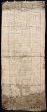
Plan of the Eastern Moiety of Township No. 46 East Parish. Kings County. P. E. Island.
Description: Plan of the eastern moiety of Lot 46, East Parish, Kings Co. (No.125). Cunard Estate. Shows names of residents and acreage, roads, and the Gulf of St. Lawrence. One of the plans referred to in the… more
Province: Prince Edward Island
Type: cadastral maps
Date Created: 1866
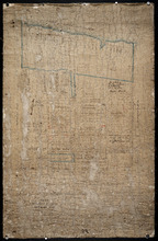
Plan of the Northern Moiety of Lot 45: compiled from surveys made by L.N. Gall and H.J. Cundall.
Description: Plan of the northern moiety of Lot 45 compiled from surveys made by L.N. Gall and H.J. Cundall. Plan referred to in deed to Commissioner of Public Land, dated 13th July, 1866. The map of the northern… more
Province: Prince Edward Island
Type: cadastral maps
Date Created: 1866