Displaying 1 - 2 of 2
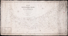
Map of Prince Edward Island, in the Gulf of St. Lawrence: Comprising the latest Topographical…
Description: Map of Prince Edward Island by George Wright, Surveyor General, 1852. Shows mail routes, roads, churches, water mills, population, boundaries, and post offices.
Province: Prince Edward Island
Type: cadastral maps
Date Created: 1852
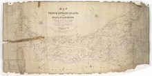
Map of Prince Edward Island, in the Gulf of St. Lawrence,: Compiling the latest Topographical…
Description: Map of Prince Edward Island by George Wright, Surveyor General, 1852. The Sea Coast, Rivers, Vc. being laid down from the Survey recently completed by Captain H. W. Bayfield R.N. The map shows mail… more
Province: Prince Edward Island
Type: cadastral maps
Date Created: 1852