Displaying 1 - 12 of 12
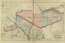
Counties of Restigouche and Madawaska: New Brunswick
Description: The maps shows the counties of Restigouche and Madawaska. Shown are Resitgouche Harbour, cities, towns, and lakes.
Publisher: Roe Brothers
Province: New Brunswick
Type: geographical maps
Date Issued (Source): 1878
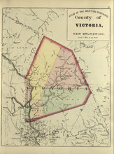
County of Victoria: New Brunswick
Description: The maps shows the county of Victoria in New Brunswick. Shown are rivers, brooks, Grand Falls, railroads and stations.
Publisher: Roe Brothers
Province: New Brunswick
Type: geographical maps
Date Issued (Source): 1878
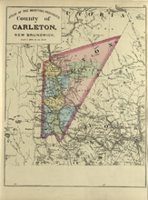
County of Carleton: New Brunswick
Description: The map shows the county of Carleton in New Brunswick. Shown are raods, railroads, towns, cities, and lakes.
Publisher: Roe Brothers
Province: New Brunswick
Type: geographical maps
Date Issued (Source): 1878
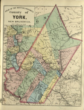
County of York: New Brunswick
Description: The map shows the county of York in New Brunswick. Shown are railroads and stations, St. Mary Ferry, Nashwaak Bridge, mills, lakes, MacAdam Junction, post offices, cities, and towns.
Publisher: Roe Brothers
Province: New Brunswick
Type: geographical maps
Date Issued (Source): 1878
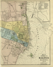
Map of the City of Halifax: Halifax Co. N.S.
Description: The map shows the city of Halifax, Halifax County in Nova Scotia. Shown are a Reference table, Halifax Harbour, pond, roads, wards, lots, buildings, and landowners.
Publisher: Roe Brothers
Province: Nova Scotia
Type: geographical maps
Date Issued (Source): 1878
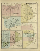
Chatham : Charlottetown : New Castle : City of Fredricton : Moncton: Northumberland Co. N.B..…
Description: The map shows Catham in the Northumberland county. New Brunswick. Shown are a river, wharf, streets, buildings, lots and a ferry crossing. The map shows Charlottetown in Queens county, Prince Edward… more
Publisher: Roe Brothers
Province: New Brunswick, Prince Edward Island
Type: geographical maps
Date Issued (Source): 1878
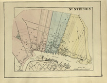
St. Stephen
Description: The map shows St. Stephen. Shown are a railroad and station, lots, wards, roads, buildings, and St. Croix River.
Publisher: Roe Brothers
Province: New Brunswick
Type: geographical maps
Date Issued (Source): 1878
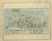
St. Andrews
Description: The map of St. Andrews. Shown are a Reference table, railroads and station, military lands, roads, lots, owners, and wharfs.
Publisher: Roe Brothers
Province: New Brunswick
Type: geographical maps
Date Issued (Source): 1878
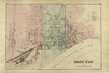
Moncton
Description: The map shows Moncton. Shown are a References table, wards, roads, railways and station, lots, buildings, landowners, and Petitcodiac River.
Publisher: Roe Brothers
Province: New Brunswick
Type: geographical maps
Date Issued (Source): 1878
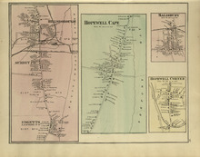
Hillsborough : Hopewell Cape : Salisbury : Hopewell Corner
Description: The map shows Hillsborough. Shown are buildings, lots, landowners, districts, Mill creek, wharfs, railways, post offices and shops. The map shows Hopewell Cape. Shown are buildings, landowners, roads… more
Publisher: Roe Brothers
Province: New Brunswick
Type: geographical maps
Date Issued (Source): 1878
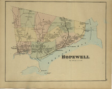
Hopewell
Description: The map shows Hopewell. Shown are a bay, island, rivers, wharf, railway and station, roads, landowners, and mountains.
Publisher: Roe Brothers
Province: New Brunswick
Type: geographical maps
Date Issued (Source): 1878
