Displaying 1 - 2 of 2
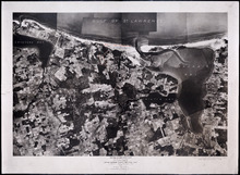
Prince Edward Island National Park: Covehead - Tracadie Section 1937
Description: Prince Edward Island National Park. Covehead - Tracadie section. Lots 34 and 35. Aerial photograph. Department of Mines and Resources, Mines and Geology Branch. Bureau of Geology and Topography. The… more
Province: Prince Edward Island
Type: cadastral maps, aerial photographs
Date Created: 1937
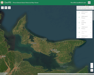
GeoPEI: Prince Edward Island Historical Map Viewer
Description: GeoPEI is a web portal developed by Dr. Josh MacFadyen and students in the GeoREACH Lab. Its purpose is to share maps, atlases, aerial photos, and geospatial data in an online map (aka. a webmap)… more
Publisher: UPEI GeoREACH Lab
Province: Prince Edward Island
Type: aerial photographs, cadastral maps
Date Created: 2024