Displaying 1 - 5 of 5
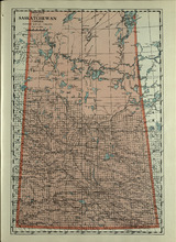
Province of Saskatchewan, Canada
Description: The map shows the province of Saskatchewan, Canada. Shown are rivers, lakes, and other bodies of water, roads, and railroads.
Publisher: Cummins Map Co.
Province: Saskatchewan, Alberta, Mantitoba
Type: cadastral maps
Date Issued (Source): 1927
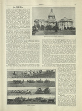
Alberta - 1
Description: Text provides information of different regions of Alberta, their history, and agriculture in Alberta
Publisher: Cummins Map Co.
Province: Alberta
Type: text
Date Issued (Source): 1927
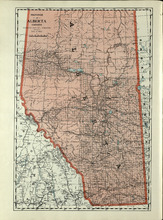
Province of Alberta, Canada
Description: The map shows the province of Alberta, Canada. Shown are bodies of water, rivers, lakes, etc., cities and towns, roads and railroads.
Publisher: Cummins Map Co.
Province: Alberta, British Columbia, Saskatchewan
Type: cadastral maps
Date Issued (Source): 1927
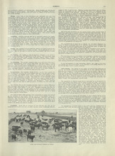
Alberta - 2
Description: Text provides information of different industries in Alberta, and the population in Alberta
Publisher: Cummins Map Co.
Province: Alberta
Type: text
Date Issued (Source): 1927
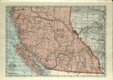
Province of British Columbia, Canada
Description: The map shows the province of British Columbia, Canada. Shown are the Pacific Ocean, Rocky Mountains, Vancouver Island, mountains, roads, and railroads.
Publisher: Cummins Map Co.
Province: British Columbia, Alberta
Type: cadastral maps
Date Issued (Source): 1927