Displaying 1 - 1 of 1
A New Chart of the Gulf of St. Lawrence Compiled from the Original Drawings of Actual Surveys
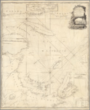
Description: The most accurate chart of the Gulf of St. Lawrence in 1790, especially its depiction of Cape Breton Island. "The Most Detailed Chart of the St. Lawrence River to Date Fine example of Thomas… more
Publisher: William Faden
Province: Prince Edward Island, Nova Scotia, New Brunswick, Quebec
Type: nautical charts
Date Created: 1790