Displaying 1 - 4 of 4

A Plan of Lot or Township No. 43, Comprising the Haviland, Townsend, and Worrell Estates. Compiled…
Description: Plan of Lot 43 (No.116) comprising the Haviland, Townshend, and Worrell Estates. Completed from the surveys of J. Ball and J.C. Underhay by Owen Curtis. Shows names of residents, acreage, and land… more
Province: Prince Edward Island
Type: cadastral maps
Date Created: 1876-08

Plan of Lot or Township No. 38: Compiled from the Survey of Jos.h Ball by O. Curtis, Land Office…
Description: Plan of Lot 38 (No.102). Shows names of residents, acreage, and some land conveyance references, bodies of water such as bays, rivers, ponds, gulfs, and harbours, roads, and a nautical compass.
Province: Prince Edward Island
Type: cadastral maps
Date Created: 1876-08
Plan showing land at Souris appropriated for the Railway : Plan signed by O. Curtis, Registrar of…
Description: Plan showing land at Souris appropriated for the Railway. Plan signed by O. Curtis, Registrar of Deeds. Shown are residents, and railroad tracks.
Province: Prince Edward Island
Type: cadastral maps
Date Created: 1879-06-18

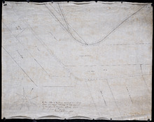
Plan of Township No 42: from Surveys by O. Curtis, August 1864
Description: Plan of Lot 42. Shows names of some residents and acreage, bodies of water such as the Gulf of St. Lawrence, roads, and a compass.
Province: Prince Edward Island
Type: cadastral maps
Date Created: 1864-08