Displaying 1 - 1 of 1
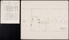
Pownal, Lot 49
Description: This item consists of a fire insurance plan of the community of Pownal and an accompanying typewritten text document. The map shows Pownal divided into numbered sections. It shows buildings and their… more
Province: Prince Edward Island
Type: fire insurance maps
Date Issued (Source): 1888