| Title Proper |
Map of the Province of Prince Edward Island
|
|---|---|
| Subtitle |
in the Gulf of St. Lawrence
|
| Description |
The map shows the province of Prince Edward Island. Shown are tables of Explanations and Electorial Districts, a compass and the county lines are marked in red. Shown are gulfs, straits, bays, reefs, lakes, ponds, rivers, points, coves, lighthouses, roads, railroads, and post offices.
|
| Access Condition |
This material is provided for research, education, and private use only.
|
| Type | |
| Physical Location |
Robertson Library, UPEI
|
| Contributors |
Creator: Allen, C. R.
|
| Date Created |
1880
|
| Date Issued (Source) |
1880
|
| Publisher |
J. H. Meacham & company
|
| Extent |
26 x 15.5 inches
|
| Scale |
scale of miles
|
| Geographic - Continent | |
| Geographic - Country | |
| Geographic - Province/State | |
| Subject (Topical) | |
| Source |
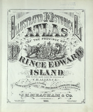
Illustrated historical atlas of the province of Prince Edward Island: From surveys made under the direction of C. R. AllenSubtitle
From surveys made under the direction of C. R. Allen

Creator: Allen, C. R.
Publisher
J. H. Meacham & company
Date Issued
1880
|