| Title Proper |
Plan of Lot Four
|
|---|---|
| Subtitle |
Prince Co., P.E.I.
|
| Description |
Map showing lots four
|
| Access Condition |
This material is provided for research, education, and private use only.
|
| Type | |
| Physical Location |
Robertson Library, UPEI
|
| Names Present on Map |
Lawrence Doyle, Alex Luttrell, John Luttrell, Daniel Sutherland, Estate of George Sturgeon, Jane Sturgeon, Arch. Coughlan, John McDonald, Thomas Campbell, James McKendrick, Bennett McKenzie, David Thompson, Alexander Coughlan, Samuel Rix, Lemuel Dalton, Thomas Costain, Edward Reilly, James Trainor, Thomas Coughlan, George Sturgeon, J. A. Matheson, Donald Smith, Levi McNeill, James Broderick, Josha Arsenault, Heirs of Isaac Gallant, Patrick Kelly, Maurice Griffin, William Mahr, William Quinn, John McMichan, John A. Matheson, Charles Gallant, ( ) Corrigan, Patrick Blanche, Estate of Peter Murphy, , Levi McNeill, Centarian Gallant, Arch. O'Halloran, Michael O'Halloran, Peter Warren, John McCarthy, Maurice Gallant, Mrs. McMillan, Alex Warren, Carl Aubery, R. Stewart, Thomas McNeill, Theodore Wright, David Thompson, John Doyle, Francis Munroe, Peter Keefe, Walter Campbell, Daniel Riley, Edward McKay, John Matheson, Charles Riley, Alex McDonald, , Peter Doyle, James Doyle, Michael Doyle, John Colfer, James Colfer, Patrick Stone, Alexander McDonald, Peter Doyle, S. M. Beckwith, John J. McDonald, Daniel Graham, James O'Halloran, John A. Matheson, John Witzell, Sylvain Arsenault, Sylvain Gallant, Edward Finnon, G.W. Hawlan, [Theophilias] Bernard, Andrew Gallant, William Goodwin, Robert Bell, James Gallant, Hubert Perry, Thomas Gallant, Peter Gallant, Alfred Wedge, Prospere Gallant, John R. Larkin, Firmain Perry, G.W. Howlan, Urban Gallant, Damian Wedge, Paul Wedge, Joseph Wedge, Lawrence Wedge, Angus Gallant, Levi Gallant, L'Aimable Gallant, Andrew Gallant, John Gallant, Firmain Gallant, Judith Gallant, Thomas [Methei eell], Thomas Mountain, Thomas Murray, Joseph Elworth, Jacob Murray, Neil McNeill, Thomas Murphy Jr., Angus Watson, R.B. Reid, Michael O'Brien, William Yeo, Hector McNeill, Samuel McNeill, Ebenezer Forsyth, Jenry Henderson, Mrs. A. Fraser, Patrick Fhey, Patrick Coughlan, John Ball, Richard Clark, A.A. Sherlock, Thomas Hunter, David Williams, George Haywood, Donald McArthur, Charles B. Champion, William Adams, Gilbert McArthur, Estate of George McRae, James Horne, James Hardy, Robert Hardy, Donald Graham, Jacob Murray, James Fraser, R. Stewart, William Welsh, Sinclair Wells, Alex Matthews, William Gallaghan, , Mitchael Brennan, Henry Wells, William Wallace, John Conroy, Henry McNeill, James Coughlan, Michael Ellsworth, James O'Brien, John Forsythe, Henry Wells, John Kelly, Thomas Cosgrove, James Currie, George Currie, William Waren, Samuel Rix, John B. McKenna, Pat O'Brien, Dennis O'Brien, William Wells, George Kelly, Ambrose Boyle, Patrick Fingleton, Charles Bernard, John Matthews, Mrs. Mountain, Arch. Mathews, , Sinclair Wells, , James Arthur, William Wallace Sr., William Wallace Jr., Arch. Ramsay, John Welsh, Malcolm Matthews, Jacob Murray, Robert Hardy, Joseph Hardy, Thomas Horn, Gilbert McArthur, Malcolm Wells, Rev. R. M. Dyer, Charles Morgan, John Bell, Thomas McNeill, John Profit, Valentine Cannon, Michael White, Donald Montgomery, John R. Gordon, John R. Oliver, Arch. Laird, John Forsyth, John S. McNeill, Alexander Bell, Ewen Campbell, Thomas Henderson, Gilbert Arthur, Malcolm McNeill, Charles Matthews, Andrew Forsyth, Jr., Edmund McArthur, William Ashley, Heirs of Alfred Ashley, Thomas Boyle, Hugh Forsythe, Allan Forsythe, John Wells, John Donald, Thomas Sage, Mrs. Allan Fraser, Henry Oliver, William R. Reid, John Ball,
John Foley, Michel Foley, George Conroy, James Conroy, Thomas Cahill, Donald Campbell, Angus Gillis, Michael Quigley, Stephen Moran, Joseph Cannon, George Gillian, Michael Fitzsimmons, Ronald McDonald, William McIntyre, W.C. Montgomery, Allan Clark, Robert Yeo, W. C. Montgomery, Henry Weeks, James Weeks, Barnabus McAlduff, Stephen McAlduff, Edward Cordon, John Pattern, John Hewett, Benjamin Campbell, Widow Hardy, Alex Meggison, Alex Larkin, John D. Woodman, James McLeod, Edmund Wallace, Patrick Cunnighan, George Muttart, Charles Bernard, Edmund Grigg, James Champion, James Larkin, William Hunter, G. W. Howlan, James Muttart, Heirs of Robert Gordon, James M. Gordon, A. Gordon, George N. Gordon, Robert Bonus, George Hardy, Robert Yeo, W.C. Montgomery, Henry Weeks, James Hunter, Benjamin Campbell, Alex Meggison, Patrick Cunningham, Edmund Wallace, Allan Clark, Thomas Gillian, Michael Quigley, Stephan Moran, Angus Gillis, Donald Campbell, |
| Date Issued (Source) |
1880
|
| Publisher |
J. H. Meacham & company
|
| Extent |
25.5 x 15.5 inches
|
| Scale |
50 chains to one inch
|
| Geographic - Continent | |
| Geographic - Country | |
| Geographic - Province/State | |
| Geographic - County | |
| Geographic - Lot/Region | |
| Geographic - City | |
| Subject (Topical) | |
| Source |
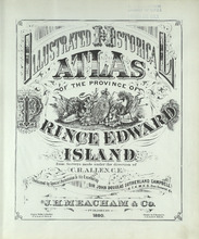
Illustrated historical atlas of the province of Prince Edward Island: From surveys made under the direction of C. R. AllenSubtitle
From surveys made under the direction of C. R. Allen

Creator: Allen, C. R.
Publisher
J. H. Meacham & company
Date Issued
1880
|